
IMAGES TAKEN NEAR TO
Sunnymead, CRAWLEY, RH11 7DY
Introduction
This page details the photographs taken nearby to Sunnymead, RH11 7DY by members of the Geograph project.
The Geograph project started in 2005 with the aim of publishing, organising and preserving representative images for every square kilometre of Great Britain, Ireland and the Isle of Man.

There are currently over 7.5m images from over14,400 individuals and you can help contribute to the project by visiting https://www.geograph.org.uk
Image Map
Images are licensed for reuse under creativecommons.org/licenses/by-sa/2.0
Notes
- Clicking on the map will re-center to the selected point.
- The higher the marker number, the further away the image location is from the centre of the postcode.
Image Listing (313 Images Found)
Images are licensed for reuse under creativecommons.org/licenses/by-sa/2.0
Image
Details
Distance
1
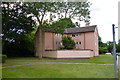
Flats, Sunnymead, West Green, Crawley
One of several blocks down this side of the road built on a three-pointed star plan.
Image: © Robin Webster
Taken: 12 Aug 2013
0.03 miles
2
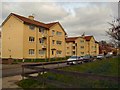
Sunnymead Conservation Area
The Crawley Development Corporation designed Sunnymead Flats in the 1950s. They were originally built for the workers involved in the construction of the New Town. Sunnymead Flats represent an example of early New Town housing and are considered to be of architectural significance. They were designated as a Conservation Area in 1997 http://www.crawley.gov.uk/stellent/idcplg?IdcService=SS_GET_PAGE&ssDocName=INT010073
Image: © Paul Gillett
Taken: 5 Mar 2011
0.05 miles
3
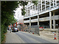
Building site, Crawley
A supermarket and hotel, with what looks like a car park, are being built on a redeveloped site. Meanwhile traffic on the one way Pegler Way eases past, reduced to one lane.
Image: © Robin Webster
Taken: 12 Aug 2013
0.05 miles
4
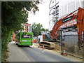
Asda bus and site redevelopment, Crawley
A supermarket and hotel, with what looks like a car park, are being built on a redeveloped site. Meanwhile traffic on the one way Pegler Way eases past, reduced to one lane.
The bus, fleet number 241, is the only one in the Metrobus public service fleet that is not either some sort of blue or London red. It runs a free shuttle service between the bus station, town centre and the Asda store, which is not very far away. It seems a very reliable performer and is hardly ever substituted.
Image: © Robin Webster
Taken: 12 Aug 2013
0.06 miles
5
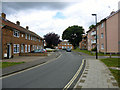
Sunnymead, West Green, Crawley
One of the earlier new town developments.
Image: © Robin Webster
Taken: 12 Aug 2013
0.07 miles
6
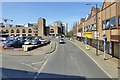
Orchard Street, Crawley
The arched building is a multi-storey car park.
Image: © Robin Webster
Taken: 18 Apr 2018
0.07 miles
7
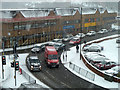
A snowy day in Crawley town
Snow started falling early in the day and continued through the morning, with a forecast continuation for some time.
Image: © Robin Webster
Taken: 18 Jan 2013
0.07 miles
9
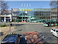
Morrisons, Crawley
Viewed from a 23 bus.
Image: © Robin Webster
Taken: 18 Apr 2018
0.08 miles
10
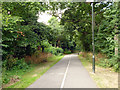
Foot and cycle way, West Green, Crawley
Running from the High Street to residential areas.
Image: © Robin Webster
Taken: 12 Aug 2013
0.09 miles