
IMAGES TAKEN NEAR TO
Hydehurst Lane, CRAWLEY, RH10 9AS
Introduction
This page details the photographs taken nearby to Hydehurst Lane, RH10 9AS by members of the Geograph project.
The Geograph project started in 2005 with the aim of publishing, organising and preserving representative images for every square kilometre of Great Britain, Ireland and the Isle of Man.

There are currently over 7.5m images from over14,400 individuals and you can help contribute to the project by visiting https://www.geograph.org.uk
Image Map
Images are licensed for reuse under creativecommons.org/licenses/by-sa/2.0
Notes
- Clicking on the map will re-center to the selected point.
- The higher the marker number, the further away the image location is from the centre of the postcode.
Image Listing (39 Images Found)
Images are licensed for reuse under creativecommons.org/licenses/by-sa/2.0
Image
Details
Distance
1
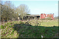
Derelict barns, former Windyridge Farm
North of Hydehurst Lane. 'Windyridge' seems a rather inappropriate name as far as the ridge bit goes.
Image: © Robin Webster
Taken: 28 Feb 2021
0.06 miles
2
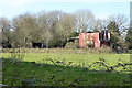
Derelict buildings, former Windyridge Farm
North of Hydehurst Lane. 'Windyridge' seems a rather inappropriate name, as far as the ridge bit goes.
Image: © Robin Webster
Taken: 28 Feb 2021
0.06 miles
3
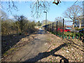
Public footpath 1528 to Rowley Farm
The route here has altered somewhat from what it was as the Crawley industrial area has grown northwards.
Image: © Robin Webster
Taken: 28 Feb 2021
0.08 miles
4
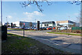
Hyundai dealers, Fleming Way, Crawley
Image: © Robin Webster
Taken: 28 Feb 2021
0.09 miles
5
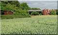
Farm buildings near Manor Royal Industrial Estate, Crawley, West Sussex
These metal clad farm buildings are in various states of dilapidation, with the central barn still intact. A row of bee hives are set in front of the barn. Wheat is growing in the field. Photo taken (looking N) from the public footpath between County Oak and Rowley Farm, just after emerging out of the Manor Royal Industrial Estate.
Image: © Pete Chapman
Taken: 6 Jul 2005
0.09 miles
6
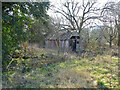
Derelict shed off Hydehurst Lane, Crawley
It seems to have been part of the late Windyridge Farm, in a field mapped as an orchard.
Image: © Robin Webster
Taken: 28 Feb 2021
0.09 miles
7
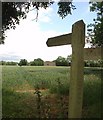
Public Footpath across fields between County Oak and Rowley Farm, Near Crawley, West Sussex.
One of several long standing public rights of way in this area. This path has been in use since long before the creation of the Manor Royal Industrial Estate, immediately behind the photographer and Gatwick Airport (1.5km N of here). The path cuts diagonally SW-NE across the fields, which are growing wheat. This area is currently (2005) being suggested as a possible location for a second runway for Gatwick International Airport.
Image: © Pete Chapman
Taken: 6 Jul 2005
0.09 miles
8
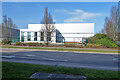
Industrial warehouse unit to let, Fleming Way, Crawley
Image: © Robin Webster
Taken: 28 Feb 2021
0.11 miles
9
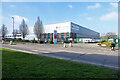
dpd depot, Fleming Way, Crawley
A parcel service, this depot has both blue and red logos, presumably two sorts of service. The blue one has a small 'local' by it.
Image: © Robin Webster
Taken: 28 Feb 2021
0.12 miles
10
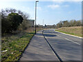
Hydehurst Lane, Crawley
Looking towards the A23. An uprating and extension of an old farm access to serve new commercial premises tacked on north of the main Crawley industrial area and not directly accessible from it (except on foot).
Image: © Robin Webster
Taken: 28 Feb 2021
0.12 miles