Public Footpath across fields between County Oak and Rowley Farm, Near Crawley, West Sussex.
Introduction
The photograph on this page of Public Footpath across fields between County Oak and Rowley Farm, Near Crawley, West Sussex. by Pete Chapman as part of the Geograph project.
The Geograph project started in 2005 with the aim of publishing, organising and preserving representative images for every square kilometre of Great Britain, Ireland and the Isle of Man.

There are currently over 7.5m images from over 14,400 individuals and you can help contribute to the project by visiting https://www.geograph.org.uk
Public Footpath across fields between County Oak and Rowley Farm, Near Crawley, West Sussex.
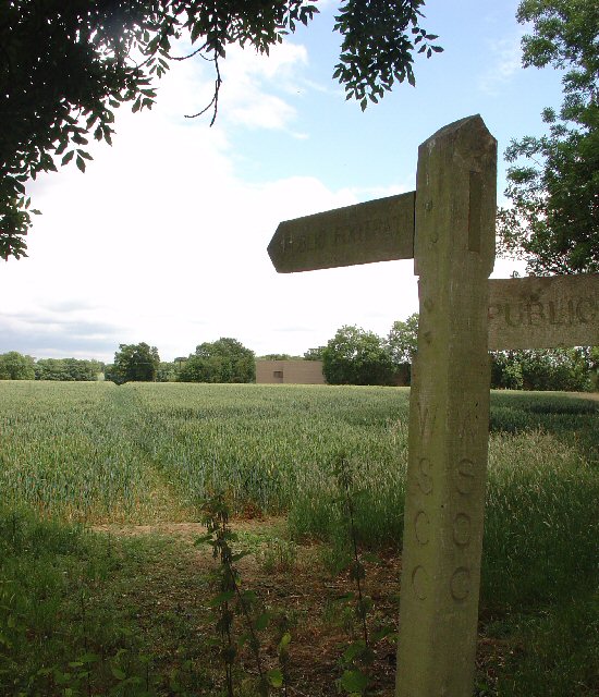
Image: © Pete Chapman Taken: 6 Jul 2005
One of several long standing public rights of way in this area. This path has been in use since long before the creation of the Manor Royal Industrial Estate, immediately behind the photographer and Gatwick Airport (1.5km N of here). The path cuts diagonally SW-NE across the fields, which are growing wheat. This area is currently (2005) being suggested as a possible location for a second runway for Gatwick International Airport.
Images are licensed for reuse under creativecommons.org/licenses/by-sa/2.0
Image Location


Leaflet Map data © OpenStreetMap
Latitude
51.136153
Longitude
-0.183291