1
Maidenbower Drive, Maidenbower, Crawley
A principal road of the neighbourhood, on the 100 bus route.
Image: © Robin Webster
Taken: 2 Mar 2023
0.04 miles
2
Flats on Townsend Way, Maidenbower, Crawley
For a view of these in 2007, see
Image
Image: © Robin Webster
Taken: 6 Jul 2021
0.07 miles
3
Townsend Way and housing construction, Maidenbower
Looking from Lucerne Drive.
Image: © Robin Webster
Taken: 14 Feb 2007
0.07 miles
4
Stream along north side of recreation ground, Maidenbower
With no apparent name, but significant enough to have flooded and closed the M23 a while back - see
Image It runs into Stanford Brook and thence to the Gatwick Stream.
Image: © Robin Webster
Taken: 6 Jul 2021
0.08 miles
5
Path from Maidenbower Drive to Lucerne Drive, Maidenbower, Crawley
Along the north side of the recreation ground, following a stream with no apparent name.
Image: © Robin Webster
Taken: 6 Jul 2021
0.08 miles
6
Parkside Development, Maidenbower, Crawley
This development will just about complete available sites in this area of Crawley. 2, 3, 4, and 5 bedroom houses are announced on the placards. The road is Lucerne Drive.
Image: © Robin Webster
Taken: 14 Feb 2007
0.08 miles
7
Path from Maidenbower Drive to Lucerne Drive, Maidenbower, Crawley
Along the north side of the recreation ground, following a stream with no apparent name.
Image: © Robin Webster
Taken: 6 Jul 2021
0.09 miles
8
Stream upstream of Maidenbower Drive
One of the streams which feeds into the Gatwick Stream and thence the River Mole. It may even be the Gatwick Stream, as the other major stream is called Stanford Brook.
Image: © Robin Webster
Taken: 26 Apr 2020
0.09 miles
9
Houses, Parkside, Maidenbower, Crawley
Image: © Robin Webster
Taken: 6 Jul 2021
0.09 miles
10
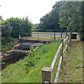
Screen on brook under Maidenbower Drive
There is some sort of monitoring system fitted, but it is not on the list of EA transmitting stations, so what is it for? Detecting screen blockage?
Image: © Robin Webster
Taken: 5 Jul 2020
0.10 miles


