IMAGES TAKEN NEAR TO
Shoreham Road, CRAWLEY, RH10 7JS
Introduction
This page details the photographs taken nearby to Shoreham Road, RH10 7JS by members of the Geograph project.
The Geograph project started in 2005 with the aim of publishing, organising and preserving representative images for every square kilometre of Great Britain, Ireland and the Isle of Man.

There are currently over 7.5m images from over14,400 individuals and you can help contribute to the project by visiting https://www.geograph.org.uk
Image Map (Loading...)


Getting Data...Please wait
Leaflet Map data © OpenStreetMap
Images are licensed for reuse under creativecommons.org/licenses/by-sa/2.0
Notes
- Clicking on the map will re-center to the selected point.
- The higher the marker number, the further away the image location is from the centre of the postcode.
Image Listing (83 Images Found)
Images are licensed for reuse under creativecommons.org/licenses/by-sa/2.0
Image
Details
Distance
1
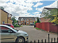
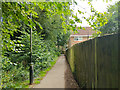
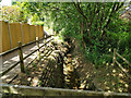
End of Shoreham Road, Maidenbower
Viewed from the Halfsmock Stream footpath.
Image: © Robin Webster
Taken: 11 Jul 2020
0.03 miles
2
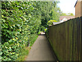
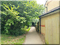
Halfsmock Stream footpath
A path running more or less closely beside the Halfsmock Stream, to the left. A wary cat is ahead.
Image: © Robin Webster
Taken: 11 Jul 2020
0.03 miles
3
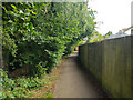
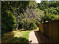
Halfsmock Stream footpath
A path running more or less closely beside the Halfsmock Stream, to the left.
Image: © Robin Webster
Taken: 11 Jul 2020
0.03 miles
4
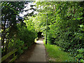
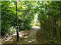
Halfsmock Stream footpath
A path running more or less closely beside the Halfsmock Stream, to the right.
Image: © Robin Webster
Taken: 11 Jul 2020
0.05 miles
5
Halfsmock Stream footpath
A path running more or less closely beside the Halfsmock Stream, to the left.
Image: © Robin Webster
Taken: 11 Jul 2020
0.05 miles
6
Halfsmock Stream footpath
A path running more or less closely beside the Halfsmock Stream, to the left.
Image: © Robin Webster
Taken: 11 Jul 2020
0.06 miles
7
Halfsmock Stream footpath
A path running more or less closely beside the Halfsmock Stream, to the left.
Image: © Robin Webster
Taken: 11 Jul 2020
0.07 miles
8
Halfsmock Stream footpath
A path running more or less closely beside the Halfsmock Stream, to the left.
Image: © Robin Webster
Taken: 11 Jul 2020
0.08 miles
9
Halfsmock Stream
Looking downstream from above the culvert under Pallingham Drive. The path follows the stream all the way from its emergence from a culvert under the M23 to its confluence with Stanford Brook.
Image: © Robin Webster
Taken: 11 Jul 2020
0.09 miles
10
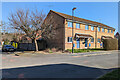
Houses on Salterns Road, Maidenbower, Crawley
Image: © Robin Webster
Taken: 2 Mar 2023
0.09 miles