
IMAGES TAKEN NEAR TO
Bligh Close, CRAWLEY, RH10 5DL
Introduction
This page details the photographs taken nearby to Bligh Close, RH10 5DL by members of the Geograph project.
The Geograph project started in 2005 with the aim of publishing, organising and preserving representative images for every square kilometre of Great Britain, Ireland and the Isle of Man.

There are currently over 7.5m images from over14,400 individuals and you can help contribute to the project by visiting https://www.geograph.org.uk
Image Map
Images are licensed for reuse under creativecommons.org/licenses/by-sa/2.0
Notes
- Clicking on the map will re-center to the selected point.
- The higher the marker number, the further away the image location is from the centre of the postcode.
Image Listing (29 Images Found)
Images are licensed for reuse under creativecommons.org/licenses/by-sa/2.0
Image
Details
Distance
1
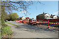
Road up on Hawth Avenue, Crawley
The road was closed to through traffic, although access to the residential roads off it had to be maintained.
Image: © Robin Webster
Taken: 24 Mar 2019
0.08 miles
2
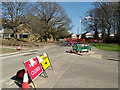
Road up on Hawth Avenue, Crawley
The road was closed to through traffic, although access to the residential roads off it had to be maintained.
Image: © Robin Webster
Taken: 24 Mar 2019
0.08 miles
3
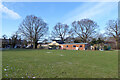
Pavilion, Loppets Road Playing Fields
It seems to be hijacked and fenced off for a child care function.
Image: © Robin Webster
Taken: 12 Feb 2021
0.09 miles
4
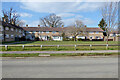
Houses around green, Shackleton Road, Tilgate, Crawley
Image: © Robin Webster
Taken: 7 Mar 2021
0.10 miles
5
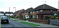
1950s Housing Estate - Rhodes Way in the Tilgate neighbourhood, Crawley, West Sussex
This is one of the older neighbourhoods of Crawley, built as the town was being developed and expanded as a "New Town". These houses were built by Taylor Woodrow in 1957. Contrasting with the housing of the more modern neighbourhood of Maidenbower (see grid square TQ2934), these houses are of a much more uniform appearance from the outside. Fifty years has allowed a few variations of porches to be built on the front, but that's about it! This part of the estate was originally built as a batch of 3 bedroom semi-detached houses (though some have since been extended to the side and the occasional loft conversion provides extra bedrooms).
Image: © Pete Chapman
Taken: 15 Sep 2005
0.12 miles
7
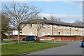
Houses on Shackleton Road, Tilgate, Crawley
Image: © Robin Webster
Taken: 7 Mar 2021
0.13 miles
8
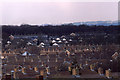
Telephoto view from Tilgate Park in 1987 (6)
The terraced housing in the photo is in Arden Road in the Furnace Green area of Crawley.
Image: © Peter Shimmon
Taken: Unknown
0.14 miles
9
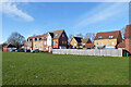
Houses north of Loppets Road Playing Fields, Furnace Green, Crawley
A newish development in a well established area of Crawley. This is because they were built on the site of the demolished Robert May Primary Schools which closed in 1997.
Image: © Robin Webster
Taken: 12 Feb 2021
0.14 miles
10
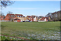
Houses north of Loppets Road Playing Fields, Furnace Green, Crawley
A newish development in a well established area of Crawley. This is because they were built on the site of the demolished Robert May Primary Schools which closed in 1997.
Image: © Robin Webster
Taken: 12 Feb 2021
0.16 miles