
IMAGES TAKEN NEAR TO
Bramble Way, CRAWLEY, RH10 4AJ
Introduction
This page details the photographs taken nearby to Bramble Way, RH10 4AJ by members of the Geograph project.
The Geograph project started in 2005 with the aim of publishing, organising and preserving representative images for every square kilometre of Great Britain, Ireland and the Isle of Man.

There are currently over 7.5m images from over14,400 individuals and you can help contribute to the project by visiting https://www.geograph.org.uk
Image Map
Images are licensed for reuse under creativecommons.org/licenses/by-sa/2.0
Notes
- Clicking on the map will re-center to the selected point.
- The higher the marker number, the further away the image location is from the centre of the postcode.
Image Listing (54 Images Found)
Images are licensed for reuse under creativecommons.org/licenses/by-sa/2.0
Image
Details
Distance
3
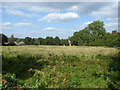
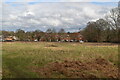
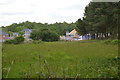
Field north of Burleigh Lane, Crawley Down
With no apparent use at the moment. It, and the disused plot of The Croft to the east, have been identified as a potential area for housing development by the planning authority. It may be relevant that a company, Burleigh Lane Crawley Down Ltd, was set up at the end of 2020 by those with interests in property development.
Image: © Robin Webster
Taken: 22 Sep 2021
0.12 miles
5
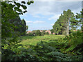
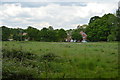
Land north of Burleigh Lane, Crawley Down
With no apparent use at the moment. It seems to be part of the disused plot of The Croft to the west, which, together with field further west, have been identified as a potential area for housing development by the planning authority. It may be relevant that a company, Burleigh Lane Crawley Down Ltd, was set up at the end of 2020 by those with interests in property development.
Image: © Robin Webster
Taken: 22 Sep 2021
0.14 miles
6
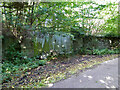
Disused entrance, The Croft, Burleigh Lane, Crawley Down
The large plot, which includes a house, appears disused. It, and the field to the west, have been identified as a potential area for housing development by the planning authority. It may be relevant that a company, Burleigh Lane Crawley Down Ltd, was set up at the end of 2020 by those with interests in property development.
The lane is a private road but public footpath, 56W.
Image: © Robin Webster
Taken: 22 Sep 2021
0.16 miles
7
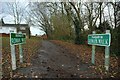
Footpath to Rowan Walk, Crawley Down
Just in case you weren't sure, this is the footpath to Rowan Walk, Crawley Down - in keeping with the Geograph rules, no digital enhancement used!
Image: © CDSnapper
Taken: 23 Nov 2008
0.16 miles
8

Kiln Road, Crawley Down
A residential road linking Station Road to Woodlands Close developed in the 1970s on the site of a former brickworks.
Image: © Simon Carey
Taken: 5 May 2024
0.16 miles
10
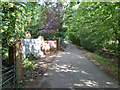
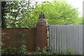
Burleigh Lane, Crawley Down by erstwhile The Croft Business Centre
The large plot, which includes a house, appears disused. It, and the field to the west, have been identified as a potential area for housing development by the planning authority. It may be relevant that a company, Burleigh Lane Crawley Down Ltd, was set up at the end of 2020 by those with interests in property development.
The lane is a private road but public footpath, 56W.
Image: © Robin Webster
Taken: 22 Sep 2021
0.17 miles