
IMAGES TAKEN NEAR TO
Clements Road, HENLEY-ON-THAMES, RG9 2HJ
Introduction
This page details the photographs taken nearby to Clements Road, RG9 2HJ by members of the Geograph project.
The Geograph project started in 2005 with the aim of publishing, organising and preserving representative images for every square kilometre of Great Britain, Ireland and the Isle of Man.

There are currently over 7.5m images from over14,400 individuals and you can help contribute to the project by visiting https://www.geograph.org.uk
Image Map
Images are licensed for reuse under creativecommons.org/licenses/by-sa/2.0
Notes
- Clicking on the map will re-center to the selected point.
- The higher the marker number, the further away the image location is from the centre of the postcode.
Image Listing (37 Images Found)
Images are licensed for reuse under creativecommons.org/licenses/by-sa/2.0
Image
Details
Distance
1
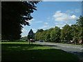
The Fair Mile, Henley
The Fair Mile, Henley taken from the town end.
Image: © Colin Bates
Taken: 8 Aug 2005
0.10 miles
2

Start of the restricted byway
The start of the restricted byway at the Fair Mile, Henley. I find this rather odd and wonder if at one time this was a road.
Image: © Bill Nicholls
Taken: 6 Nov 2011
0.12 miles
3

Dedication on the Pillar
View of the commemoration plaque on the pillar along the restricted byway at Henley.
Image: © Bill Nicholls
Taken: 6 Nov 2011
0.12 miles
4

Pillar on the Byway
A pillar stands with a commemoration plaque beside the byway at Fair Mile, Henley.
Image: © Bill Nicholls
Taken: 6 Nov 2011
0.13 miles
5
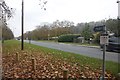
Restricted Byway
Bit of a strange thing to see alongside a main road just outside Henley
Image: © Bill Nicholls
Taken: 6 Nov 2011
0.13 miles
7
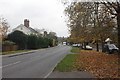
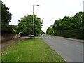
Into Henley
The end of the Fair Mile as you get into the Town of Henley.
Image: © Bill Nicholls
Taken: 6 Nov 2011
0.14 miles
8

The Fair Mile
View along the Fair Mile at Henley from beside the Byway.
Image: © Bill Nicholls
Taken: 6 Nov 2011
0.14 miles
9

Hillside above Henley
Looking down from the woodland edge on The Mount across the dry valley containing the Fairmile.
Image: © Andrew Smith
Taken: 22 Nov 2008
0.14 miles
10

Beside the Fair Mile, Henley
The road, the A4130, is entering the town from the northwest. The straight has wide grass verges lined with trees and runs through a dry valley. The track to the right here is ostensibly a pavement, but officially the restricted byway that runs parallel to the road for about 500 metres.
Image: © Andrew Smith
Taken: 22 Nov 2008
0.14 miles