IMAGES TAKEN NEAR TO
Kybes Lane, READING, RG7 1NQ
Introduction
This page details the photographs taken nearby to Kybes Lane, RG7 1NQ by members of the Geograph project.
The Geograph project started in 2005 with the aim of publishing, organising and preserving representative images for every square kilometre of Great Britain, Ireland and the Isle of Man.

There are currently over 7.5m images from over14,400 individuals and you can help contribute to the project by visiting https://www.geograph.org.uk
Image Map
Images are licensed for reuse under creativecommons.org/licenses/by-sa/2.0
Notes
- Clicking on the map will re-center to the selected point.
- The higher the marker number, the further away the image location is from the centre of the postcode.
Image Listing (46 Images Found)
Images are licensed for reuse under creativecommons.org/licenses/by-sa/2.0
Image
Details
Distance
1
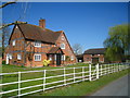
Hopkiln Farm
A fine looking house but the photo doesn't tell the whole story, there is the constant noise of the M4 in the background!
Image: © Fernweh
Taken: 27 Mar 2012
0.01 miles
2
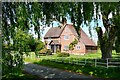
Hopkiln Farm
The first bit of peace you get coming south-west from Reading and across the M4. This is Kybes Lane, the route of National Cycle Network (NCN) route 27 between Reading and Basingstoke.
Image: © Graham Horn
Taken: 26 Apr 2009
0.01 miles
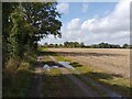
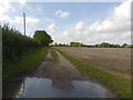
4
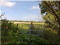
Gate on footpath near Hopkiln Farm
A public footpath between Kybes Lane and Burnthouse Lane.
Image: © Oscar Taylor
Taken: 25 Sep 2023
0.04 miles
5
Footpath towards Burnthouse Lane
A public footpath between Kybes Lane and Burnthouse Lane.
Image: © Oscar Taylor
Taken: 25 Sep 2023
0.05 miles
6
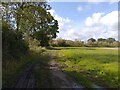
Footpath towards Burnthouse Lane
A public footpath between Kybes Lane and Burnthouse Lane.
Image: © Oscar Taylor
Taken: 25 Sep 2023
0.05 miles
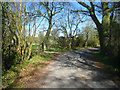
7
Footpath over Hopkiln Farm Airstrip
A public footpath between Kybes Lane and Burnthouse Lane. The airstrip is just mown grass.
Image: © Oscar Taylor
Taken: 25 Sep 2023
0.06 miles
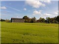
9
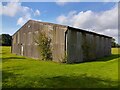
Hopkiln Farm barn
Beside a public footpath.
Image: © Oscar Taylor
Taken: 25 Sep 2023
0.06 miles
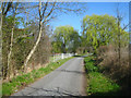
10
Footpath towards Burnthouse Lane
A public footpath between Kybes Lane and Burnthouse Lane.
Image: © Oscar Taylor
Taken: 25 Sep 2023
0.08 miles