IMAGES TAKEN NEAR TO
Wood Lane, READING, RG4 9SW
Introduction
This page details the photographs taken nearby to Wood Lane, RG4 9SW by members of the Geograph project.
The Geograph project started in 2005 with the aim of publishing, organising and preserving representative images for every square kilometre of Great Britain, Ireland and the Isle of Man.

There are currently over 7.5m images from over14,400 individuals and you can help contribute to the project by visiting https://www.geograph.org.uk
Image Map
Images are licensed for reuse under creativecommons.org/licenses/by-sa/2.0
Notes
- Clicking on the map will re-center to the selected point.
- The higher the marker number, the further away the image location is from the centre of the postcode.
Image Listing (11 Images Found)
Images are licensed for reuse under creativecommons.org/licenses/by-sa/2.0
Image
Details
Distance
1
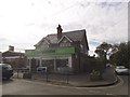
Co-operative food store, Sonning Common
This was Somerfield previously.
Image: © David Howard
Taken: 9 Aug 2015
0.12 miles
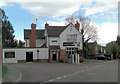
2
Supermarket and Village Hall, Wood Lane
Somerfield's is on the corner of Woodlands Road. The building to the left of it, with clock tower, is the Village Hall.
Image: © Rose and Trev Clough
Taken: 15 Oct 2007
0.12 miles
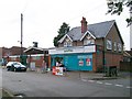
4
Telephone Exchange, Sonning Common
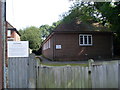
This red-brick TE is situated in Reades Lane and used to take the name "Kidmore End" from the place nearby, until all these TEs became known by their area codes. In this case, it is 0118 972. The warning notice indicates that it is private property and belongs to BT, although it dates from the GPO era. Its postcode is RG4 9LP.
Image: © David Hillas
Taken: 8 Aug 2009
0.17 miles
5
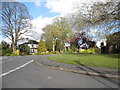
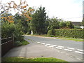
Kidmore Lane at the junction of Reade's Lane
Image: © David Howard
Taken: 3 May 2015
0.18 miles
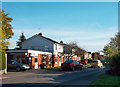
6
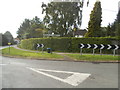
Baskerville Road
I can now reveal to a breathless world my part in creating the slight kink in this road. I owned the white painted bungalow on the right during the late 60's early 70's and initially the road was unadopted, gravel and full of large puddles. The council called a meeting announcing that they would adopt the road and tarmac it but everyone would lose a bit of front garden in the process. In their original plan properties on the right of the picture would have ended up with virtually no front garden at all, so after consultations with neighbours and the council we all agreed on the present, more equitable, sweep to the left.
Image: © Stuart Logan
Taken: 26 Apr 2012
0.18 miles
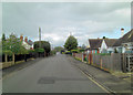
9
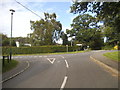
Kidmore Lane at the junction of Reade's Lane
Image: © David Howard
Taken: 9 Aug 2015
0.21 miles