
IMAGES TAKEN NEAR TO
Wokingham Road, CROWTHORNE, RG45 7QD
Introduction
This page details the photographs taken nearby to Wokingham Road, RG45 7QD by members of the Geograph project.
The Geograph project started in 2005 with the aim of publishing, organising and preserving representative images for every square kilometre of Great Britain, Ireland and the Isle of Man.

There are currently over 7.5m images from over14,400 individuals and you can help contribute to the project by visiting https://www.geograph.org.uk
Image Map
Images are licensed for reuse under creativecommons.org/licenses/by-sa/2.0
Notes
- Clicking on the map will re-center to the selected point.
- The higher the marker number, the further away the image location is from the centre of the postcode.
Image Listing (7 Images Found)
Images are licensed for reuse under creativecommons.org/licenses/by-sa/2.0
Image
Details
Distance
2

Crowthorne & Crown Wood Cricket Club, Derby Field
Image: © JThomas
Taken: 28 Jul 2022
0.18 miles
4
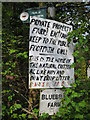
Poetry in the Country
Sign at the start of the footpath by Bluebell Wood.
Image: © don cload
Taken: 18 Apr 2009
0.23 miles

6
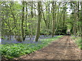
Bluebell Wood, near Ambarrow
This wood is known locally as Bluebell Wood and the track, which is a public footpath, leads to Bluebell Farm. On the 1:25000 map the wood is named Coalpit Copse, which is a very strange name considering that the nearest Coalpit is hundreds of miles away.
Image: © don cload
Taken: 18 Apr 2009
0.24 miles
7

Railway track south of Crowthorne station
Taken from a now reopened footbridge over the cross-country line from Redhill to Reading. Although most of this line is electrified the bits between Reigate- Shalford Junction and Ash-Wokingham (on which the section seen here is located) are not. Pollock Bridge can be seen in the middle distance.
Image: © David Kemp
Taken: 25 Feb 2022
0.24 miles