IMAGES TAKEN NEAR TO
Arenal Drive, CROWTHORNE, RG45 7JN
Introduction
This page details the photographs taken nearby to Arenal Drive, RG45 7JN by members of the Geograph project.
The Geograph project started in 2005 with the aim of publishing, organising and preserving representative images for every square kilometre of Great Britain, Ireland and the Isle of Man.

There are currently over 7.5m images from over14,400 individuals and you can help contribute to the project by visiting https://www.geograph.org.uk
Image Map
Images are licensed for reuse under creativecommons.org/licenses/by-sa/2.0
Notes
- Clicking on the map will re-center to the selected point.
- The higher the marker number, the further away the image location is from the centre of the postcode.
Image Listing (38 Images Found)
Images are licensed for reuse under creativecommons.org/licenses/by-sa/2.0
Image
Details
Distance
1
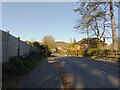
Grant Road
A cul-de-sac off Pinehill Road.
Image: © Oscar Taylor
Taken: 4 Apr 2023
0.05 miles
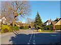
2
Pinehill Road
A road between Gordon Road and Sandhurst Road in Crowthorne.
Image: © Oscar Taylor
Taken: 4 Apr 2023
0.06 miles
3
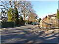
Sandhurst Road
Looking north along Sandhurst Road from the junction to Pinehill Road in Crowthorne.
Image: © Oscar Taylor
Taken: 4 Apr 2023
0.08 miles
4
Pinehill Road
A road between Gordon Road and Sandhurst Road in Crowthorne.
Image: © Oscar Taylor
Taken: 4 Apr 2023
0.08 miles
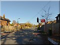
5
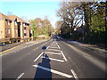
Sandhurst Road in Crowthorne
Taken from the traffic island outside Edgebarrow School looking towards the centre of Crowthorne.
Image: © Paul Merrill
Taken: 2 Jan 2010
0.09 miles
6
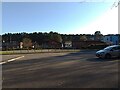
Edgbarrow Secondary School
Edgbarrow Secondary School in Crowthorne. The car park is usually completely full of cars! The tall building on the far right is the newest.
Image: © Oscar Taylor
Taken: 4 Apr 2023
0.09 miles
7
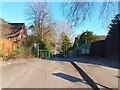
Edgbarrow Secondary School entrance
The staff and deliveries entrance to Edgbarrow Secondary School off Sandhurst Road.
Image: © Oscar Taylor
Taken: 4 Apr 2023
0.11 miles
8
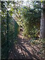
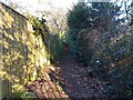
Path beside Edgbarrow Secondary School
A public footpath runs around the grounds of Edgbarrow Secondary School. At this point it runs between Jerome Corner and unused land behind Edgbarrow Sports Centre.
Image: © Oscar Taylor
Taken: 4 Apr 2023
0.12 miles
9
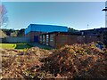
Edgbarrow Sports Centre
The sports centre at Edgbarrow Secondary School. This is the rear of the building.
Image: © Oscar Taylor
Taken: 4 Apr 2023
0.12 miles
10
Path beside Edgbarrow Secondary School
A public footpath runs around the grounds of Edgbarrow Secondary School from Wildmoor Heath. At this point it runs between Jerome Corner and the large playing field.
Image: © Oscar Taylor
Taken: 4 Apr 2023
0.14 miles