
IMAGES TAKEN NEAR TO
Alderbrook Close, CROWTHORNE, RG45 6DZ
Introduction
This page details the photographs taken nearby to Alderbrook Close, RG45 6DZ by members of the Geograph project.
The Geograph project started in 2005 with the aim of publishing, organising and preserving representative images for every square kilometre of Great Britain, Ireland and the Isle of Man.

There are currently over 7.5m images from over14,400 individuals and you can help contribute to the project by visiting https://www.geograph.org.uk
Image Map
Images are licensed for reuse under creativecommons.org/licenses/by-sa/2.0
Notes
- Clicking on the map will re-center to the selected point.
- The higher the marker number, the further away the image location is from the centre of the postcode.
Image Listing (29 Images Found)
Images are licensed for reuse under creativecommons.org/licenses/by-sa/2.0
Image
Details
Distance
1
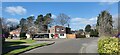
Knowles Avenue junction with Alderbrook Close
Detached houses near to Crowthorne Railway Station.
Image: © James Emmans
Taken: 2 Apr 2021
0.02 miles
3
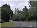
Looking from Fincham End Drive into Duke's Ride
Image: © Basher Eyre
Taken: 13 Jul 2015
0.10 miles
4
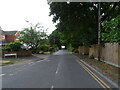
Looking north on Ravenswood Avenue, Crowthorne
Image: © JThomas
Taken: 28 Jul 2022
0.10 miles
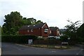
6
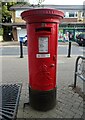
George V postbox, Crowthorne News and Post Office
Postbox No. RG45 100.
See Image] for context.
Image: © JThomas
Taken: 28 Jul 2022
0.16 miles
7
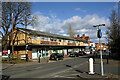
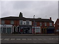
Shopping parade in Duke's Ride, Crowthorne
Image: © David Kemp
Taken: 25 Feb 2022
0.16 miles
8
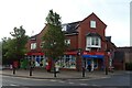
Crowthorne News and Post Office
On Duke's Ride.
Showing position of Postbox No. RG45 100.
See Image] for postbox.
Image: © JThomas
Taken: 28 Jul 2022
0.16 miles
10
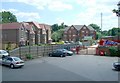
St Francis Close, Crowthorne
The tarmac area would have been the approach to the railway station many years ago but now serves the businesses that inhabit the former station building. The apartment building at centre stands just about where the railway siding was; this is St Francis Close.
When the station opened in the 19th century the siding was used to transport building materials for the construction of Wellington College and then, during the 20th century, for household coal etc.
Image: © Anthony Eden
Taken: Unknown
0.18 miles