
IMAGES TAKEN NEAR TO
Palmer School Road, WOKINGHAM, RG40 1TJ
Introduction
This page details the photographs taken nearby to Palmer School Road, RG40 1TJ by members of the Geograph project.
The Geograph project started in 2005 with the aim of publishing, organising and preserving representative images for every square kilometre of Great Britain, Ireland and the Isle of Man.

There are currently over 7.5m images from over14,400 individuals and you can help contribute to the project by visiting https://www.geograph.org.uk
Image Map
Images are licensed for reuse under creativecommons.org/licenses/by-sa/2.0
Notes
- Clicking on the map will re-center to the selected point.
- The higher the marker number, the further away the image location is from the centre of the postcode.
Image Listing (105 Images Found)
Images are licensed for reuse under creativecommons.org/licenses/by-sa/2.0
Image
Details
Distance
1
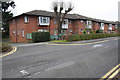
Meachen Court, Palmer School Road
Sheltered housing on site of the former Palmer School
Image: © Roger Templeman
Taken: 9 Mar 2015
0.03 miles
2
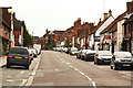
Rose Street
Street of historic houses, pubs and shops in Wokingham old town
Image: © Richard Croft
Taken: 20 Jun 2012
0.08 miles
3
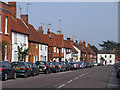
Rose Street, Wokingham
Probably the town's most attractive street, largely unaffected by the 20th century architecture to be seen elsewhere. It's also relatively traffic-free.
Image: © Andrew Smith
Taken: 19 Sep 2009
0.09 miles
4

Benchmark on Rectory Road wall at Waitrose car park entrance
Ordnance Survey cut mark benchmark described on the Bench Mark Database at http://www.bench-marks.org.uk/bm34472
Image: © Roger Templeman
Taken: 22 May 2010
0.10 miles
5

Entrance to Waitrose from Rectory Road
There is an OS benchmark Image on the curved brick wall about 1ft right of the wooden fence
Image: © Roger Templeman
Taken: 9 Mar 2015
0.10 miles
6

Benchmark on #20 Wiltshire Road
Ordnance Survey cut mark benchmark described on the Bench Mark Database at http://www.bench-marks.org.uk/bm34475
Image: © Roger Templeman
Taken: 25 Feb 2015
0.10 miles
7
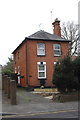
#20 Wiltshire Road
There is an OS benchmark Image on the left hand side of the house near its front corner
Image: © Roger Templeman
Taken: 9 Mar 2015
0.10 miles

9
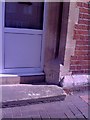
Wokingham, Methodist Church benchmark
1964 Ordnance Survey cut mark benchmark on former doorway of the Methodist Church on Rose Street, levelled at 71.2561m above Newlyn datum. Additional information about this and neighbouring benchmarks may be found in Bench Mark Database record http://www.bench-marks.org.uk/bm27562.
Image: © Roger Templeman
Taken: 22 May 2010
0.11 miles
