IMAGES TAKEN NEAR TO
Seymour Place, HOOK, RG29 1AY

Introduction

This page details the photographs taken nearby to Seymour Place, RG29 1AY by members of the Geograph project.

The Geograph project started in 2005 with the aim of publishing, organising and preserving representative images for every square kilometre of Great Britain, Ireland and the Isle of Man.

There are currently over 7.5m images from over14,400 individuals and you can help contribute to the project by visiting https://www.geograph.org.uk

Image Map


Images are licensed for reuse under creativecommons.org/licenses/by-sa/2.0
Notes
  • Clicking on the map will re-center to the selected point.
  • The higher the marker number, the further away the image location is from the centre of the postcode.

Image Listing (284 Images Found)

Images are licensed for reuse under creativecommons.org/licenses/by-sa/2.0
  • ...
Image
Details
Distance
1
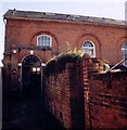
Former Congregational Chapel, Odiham
Grade 2 listed building erected in 1794. Closed in 1958 and became All Saints Church Centre. Now used as a private residence.
Image: © Michael FORD Taken: Unknown
0.02 miles
2
Odiham War Memorial
At the east end of the High Street where the road looks wide enough to have hosted a market. The memorial carries many names from nearby RAF Odiham.
Image: © Colin Smith Taken: 25 Jan 2008
0.04 miles
3
High Street, Odiham
The eastern end of High Street at the junction of London Road (ahead) and with Farnham Road continuing to the right. The cottages to the left have 16th century origins masked by 18th century brickwork. The remainder are 18th/19th century. All of the white painted cottages have addresses on the High Street.
Image: © Andrew Smith Taken: 30 Aug 2008
0.04 miles
4
High Street / Farnham Road, Odiham
The road continuing to the right is Farnham Road but the first property, an alternative medicine clinic, is 2 High Street. The property is called Charltons and would appear to have been a bakery. London Road is to the left.
Image: © Andrew Smith Taken: 30 Aug 2008
0.04 miles
5
Farnham Road, Odiham
Looking towards the commencement of High Street (at the white cottage). This was formerly the A287 but the village is now bypassed meaning that it is just about possible to stand in the middle of the road taking photographs.
Image: © Andrew Smith Taken: 30 Aug 2008
0.04 miles
6
High Street, Odiham
Looking towards the village centre along the characterful High Street. London Road goes off to the right. The property on the right offers alternative medicine, not bread.
Image: © Andrew Smith Taken: 30 Aug 2008
0.04 miles
7
Odiham - Houses
Houses in the High Street.
Image: © Chris Talbot Taken: 6 Apr 2012
0.05 miles
8
Odiham - Houses On The High Street
A nice sweep of houses on the High Street.
Image: © Chris Talbot Taken: 6 Apr 2012
0.05 miles
9
Odiham - Houses On the High Street
A fine collection of houses on the High Street.
Image: © Chris Talbot Taken: 6 Apr 2012
0.06 miles
10
War Memorial and houses on High Street, Odiham
Image: © JThomas Taken: 27 Jul 2022
0.06 miles
  • ...