
IMAGES TAKEN NEAR TO
Winton Road, READING, RG2 8HJ
Introduction
This page details the photographs taken nearby to Winton Road, RG2 8HJ by members of the Geograph project.
The Geograph project started in 2005 with the aim of publishing, organising and preserving representative images for every square kilometre of Great Britain, Ireland and the Isle of Man.

There are currently over 7.5m images from over14,400 individuals and you can help contribute to the project by visiting https://www.geograph.org.uk
Image Map
Images are licensed for reuse under creativecommons.org/licenses/by-sa/2.0
Notes
- Clicking on the map will re-center to the selected point.
- The higher the marker number, the further away the image location is from the centre of the postcode.
Image Listing (15 Images Found)
Images are licensed for reuse under creativecommons.org/licenses/by-sa/2.0
Image
Details
Distance

2

Shinfield Park ("Goodrest") and its history
The building is a converted 17th century ornamental Gothic mansion built in 1630 by Sir Francis Englefield and known as “Goodrest”, so named (it is said) because, during the Civil War, it was where an exhausted Cromwell stayed in 1643 after the battle of Newbury. The estate is also known by its original name, Shinfield Park, and in the map of 1882, such was the size of the gardens and orchards to the south of the mansion that some twenty gardeners were needed to look after them. A retired judge of the Indian Civil Service, John Dawson Mayne (1828-1917) from an Irish family, lived here with his second wife Annie Katherine from 1877 until his death. He was famous for having written the first Indian Penal Code (later expanded by Coutts-Trotter). After his death the north-west half of the grounds were sold off for housing which necessitated the filling in of a lake. The remainder of the estate is now a school (Crosfields School http://www.crosfields.com/ , part of the Leighton Park Trust) enveloped by the expansion of Reading.
Image: © D Gore
Taken: Unknown
0.13 miles


5

A327 Shinfield Road
Heading towards central Reading.
Image: © Robin Webster
Taken: 22 Aug 2020
0.19 miles
6
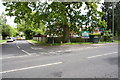
Junction of Shinfield Road and Halls Lane
Image: © Roger Templeman
Taken: 12 May 2014
0.19 miles
7

Benchmark on #241 Hartland Road
Ordnance Survey cut mark benchmark described on the Bench Mark Database at http://www.bench-marks.org.uk/bm59659
Image: © Roger Templeman
Taken: 4 Jul 2014
0.19 miles
8

#241 Hartland Road
There is an OS benchmark Image on the left hand side of the house near its front corner
Image: © Roger Templeman
Taken: 4 Jul 2014
0.19 miles
9

A327 Shinfield Road
Heading towards central Reading.
Image: © Robin Webster
Taken: 22 Aug 2020
0.21 miles
