IMAGES TAKEN NEAR TO
Wix Road, BASINGSTOKE, RG24 9ZF
Introduction
This page details the photographs taken nearby to Wix Road, RG24 9ZF by members of the Geograph project.
The Geograph project started in 2005 with the aim of publishing, organising and preserving representative images for every square kilometre of Great Britain, Ireland and the Isle of Man.

There are currently over 7.5m images from over14,400 individuals and you can help contribute to the project by visiting https://www.geograph.org.uk
Image Map
Images are licensed for reuse under creativecommons.org/licenses/by-sa/2.0
Notes
- Clicking on the map will re-center to the selected point.
- The higher the marker number, the further away the image location is from the centre of the postcode.
Image Listing (26 Images Found)
Images are licensed for reuse under creativecommons.org/licenses/by-sa/2.0
Image
Details
Distance
1
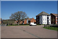
Hutchins Way
New housing on the north side of Basingstoke.
Compared with some new developments, quite a lot of open space has been left.
A lone surviving tree from whatever was here before is still there in the middle of a small green.
Image: © Des Blenkinsopp
Taken: 4 Apr 2023
0.10 miles
2
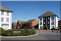
Jennings Way and Hutchins Way
Part of an extensive new housing development on the north side of Basingstoke.
Image: © Des Blenkinsopp
Taken: 4 Apr 2023
0.13 miles
3
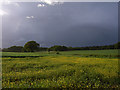
Storm-clouds near Sherborne St John
On the footpath from the Popley area of Basingstoke.
Image: © Andrew Smith
Taken: 21 May 2006
0.14 miles
4

A Pond for the Newts
It seems that before all these houses arrived the ponds and streams on this bit of land were home to rare Great Crested Newts.
According to information panels beside the water, much has been done to hopefully keep the newts happy in spite of their new neighbours.
Image: © Des Blenkinsopp
Taken: 4 Apr 2023
0.14 miles

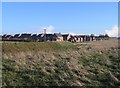
7

Farmland near Popley
Looking up to Spier's Copse.
Image: © Andrew Smith
Taken: 21 May 2006
0.16 miles

9

Paice Gardens
Part of a large new housing development on the northern edge of Basingstoke.
Image: © Des Blenkinsopp
Taken: 4 Apr 2023
0.17 miles