
IMAGES TAKEN NEAR TO
Crux Easton, NEWBURY, RG20 9QE
Introduction
This page details the photographs taken nearby to RG20 9QE by members of the Geograph project.
The Geograph project started in 2005 with the aim of publishing, organising and preserving representative images for every square kilometre of Great Britain, Ireland and the Isle of Man.

There are currently over 7.5m images from over14,400 individuals and you can help contribute to the project by visiting https://www.geograph.org.uk
Image Map
Images are licensed for reuse under creativecommons.org/licenses/by-sa/2.0
Notes
- Clicking on the map will re-center to the selected point.
- The higher the marker number, the further away the image location is from the centre of the postcode.
Image Listing (7 Images Found)
Images are licensed for reuse under creativecommons.org/licenses/by-sa/2.0
Image
Details
Distance
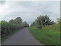
2

Crux Easton Lane
Towards the A343 and thence Newbury.
Image: © Robin Webster
Taken: 25 Apr 2021
0.07 miles

4

Cross Lane off A343
Cross Lane off Red Hill (the A343), looking towards Ashmansworth.
Image: © Oscar Taylor
Taken: 28 Apr 2023
0.18 miles
5

A343 southwest of Three Legged Cross
A classic sunken downland road but given the average vehicle speed along it; where would one safely wait for the bus?
Image: © Stuart Logan
Taken: 14 Feb 2013
0.18 miles
6

The Three Legged Cross
Once a pub but now a private house, this is situated on the A343 on the summit of the downs south of Newbury. The ridgeway track known as the Ox Drove passes in front of the building.
Image: © Ron Strutt
Taken: 4 Oct 2005
0.21 miles
7
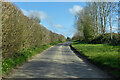
Crux Easton Lane
Northwards from Crux Easton.
Image: © Robin Webster
Taken: 25 Apr 2021
0.23 miles