
IMAGES TAKEN NEAR TO
Lower Green, HUNGERFORD, RG17 9DW
Introduction
This page details the photographs taken nearby to Lower Green, RG17 9DW by members of the Geograph project.
The Geograph project started in 2005 with the aim of publishing, organising and preserving representative images for every square kilometre of Great Britain, Ireland and the Isle of Man.

There are currently over 7.5m images from over14,400 individuals and you can help contribute to the project by visiting https://www.geograph.org.uk
Image Map
Images are licensed for reuse under creativecommons.org/licenses/by-sa/2.0
Notes
- Clicking on the map will re-center to the selected point.
- The higher the marker number, the further away the image location is from the centre of the postcode.
Image Listing (20 Images Found)
Images are licensed for reuse under creativecommons.org/licenses/by-sa/2.0
Image
Details
Distance
1
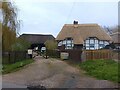
Bridgemans and Belvedere barn, Lower Green
A barn (to the left) and a cottage (to the right) in Lower Green, Inkpen.
The barn (Belvedere barn) is from the late 17th century and is a grade II listed building, list entry number 1290558 https://historicengland.org.uk/listing/the-list/list-entry/1290558
Bridgemans (the cottage) is from the 16th and 17th century and is a grade II listed building, list entry number 1221227 https://historicengland.org.uk/listing/the-list/list-entry/1221227
Image: © Oscar Taylor
Taken: 30 Apr 2023
0.00 miles
3
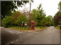
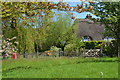
Inkpen: Lower Green
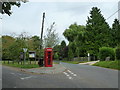
A village green to the west of Inkpen proper, including telephone box, postbox and a tree with a bench beneath it.
Image: © Chris Downer
Taken: 1 Jun 2010
0.02 miles
4
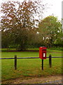
Inkpen: postbox № RG17 159
This postbox stands with its back to the green at Lower Green – in the background is a tree with a bench surrounding its trunk.
Image: © Chris Downer
Taken: 1 Jun 2010
0.02 miles
5
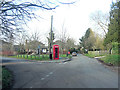
Inkpen Village Green
Nobody's straightened up the telegraph pole since Chris took a picture from this spot two and a half years ago but the road to the left leads to the excellent Swan pub and farm shop. Landmarks are important in Inkpen because it's easy to go around in circles.
Image: © Stuart Logan
Taken: 5 Mar 2013
0.02 miles
7
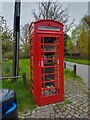
Lower Green phone box
A phone box at Lower Green, converted to a library.
Image: © Oscar Taylor
Taken: 30 Apr 2023
0.02 miles
8
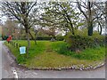
Village green at Lower Green
The village green at Lower Green.
Image: © Oscar Taylor
Taken: 30 Apr 2023
0.02 miles
9
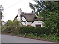
The Mead (Cruck Cottage), Lower Green
The Mead (or Cruck Cottage) is a cottage in Lower Green in Inkpen. It is a 16th and 17th century thatched cottage with 20th century additions. Not much of the cottage can be seen from the road. The cottage is Grade II listed, list entry number 1221228 https://historicengland.org.uk/listing/the-list/list-entry/1221228
Image: © Oscar Taylor
Taken: 30 Apr 2023
0.03 miles
10
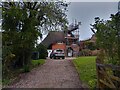
Gallants View (Gallent View), Lower Green
Gallants View (or Gallent View) in Lower Green is a thatched house. The building isn't listed.
Image: © Oscar Taylor
Taken: 30 Apr 2023
0.03 miles