
IMAGES TAKEN NEAR TO
Northfields, HUNGERFORD, RG17 8YJ
Introduction
This page details the photographs taken nearby to Northfields, RG17 8YJ by members of the Geograph project.
The Geograph project started in 2005 with the aim of publishing, organising and preserving representative images for every square kilometre of Great Britain, Ireland and the Isle of Man.

There are currently over 7.5m images from over14,400 individuals and you can help contribute to the project by visiting https://www.geograph.org.uk
Image Map
Images are licensed for reuse under creativecommons.org/licenses/by-sa/2.0
Notes
- Clicking on the map will re-center to the selected point.
- The higher the marker number, the further away the image location is from the centre of the postcode.
Image Listing (12 Images Found)
Images are licensed for reuse under creativecommons.org/licenses/by-sa/2.0
Image
Details
Distance
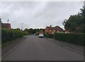
2
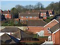
Houses, Lambourn
At the northern extremity of the village. In the foreground are new houses on North Farm Close and climbing up the hillside are the less modern ones of Northfields.
Image: © Andrew Smith
Taken: 10 Feb 2008
0.06 miles
3
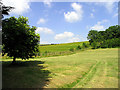
Farmland: Lambourn
This square contains the end of the village of Lambourn and farmland. This view taken from North Farm Close (the road between the B4001 and the minor road), looks north east across the field towards the top of the hill.
Image: © Pam Brophy
Taken: 9 Jul 2005
0.08 miles
4
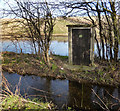
North Farm OBH
In the kiosk is an observation borehole (OBH) used by the Environment Agency for monitoring groundwater levels in the chalk aquifer.
Not that you could get to it just now as it's on an island in the Mile End stream, itself a result of high groundwater.
Image: © Des Blenkinsopp
Taken: 4 Mar 2013
0.10 miles
5
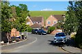
North Farm Close, Lambourn
Looking into the small modern development on the site of an eponymous farm from the B4001 as it leaves the village.
Image: © Andrew Smith
Taken: 12 Jun 2021
0.11 miles
6
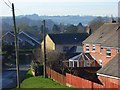
Sheepdrove Road, Lambourn
The road enters the village with the rear of houses on North Farm Close to the right.
Image: © Andrew Smith
Taken: 10 Feb 2008
0.12 miles
7
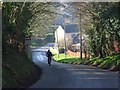
Sheepdrove Road, Lambourn
Free-wheeling on the final stretch of the descent into the village.
Image: © Andrew Smith
Taken: 10 Feb 2008
0.15 miles
8
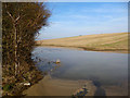
The Mile End Stream at North Farm
The Mile End Stream is an ephemeral groundwater fed chalk stream which only flows in exceptionally wet years when the water table is unusually high.
Image: © Des Blenkinsopp
Taken: 4 Mar 2013
0.15 miles
9
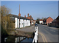
Oxford Street
Or B4001. Round the corner it changes its name to Wantage Road, a bit more local.
The Lambourn is flowing well here at the moment. In summer it dries up as far as Shefford about 8km downstream. In wet years a tributary stream forms beside this road for 2 km or so up the valley to the north..
Image: © Des Blenkinsopp
Taken: 8 Mar 2011
0.21 miles
10
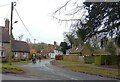
Goose Green, Lambourn
Looking down Goose Green, a lane leading to Honey Hill in Lambourn.
Image: © Oscar Taylor
Taken: 29 Jan 2024
0.22 miles