
IMAGES TAKEN NEAR TO
Upper Lambourn, HUNGERFORD, RG17 8QP
Introduction
This page details the photographs taken nearby to RG17 8QP by members of the Geograph project.
The Geograph project started in 2005 with the aim of publishing, organising and preserving representative images for every square kilometre of Great Britain, Ireland and the Isle of Man.

There are currently over 7.5m images from over14,400 individuals and you can help contribute to the project by visiting https://www.geograph.org.uk
Image Map
Images are licensed for reuse under creativecommons.org/licenses/by-sa/2.0
Notes
- Clicking on the map will re-center to the selected point.
- The higher the marker number, the further away the image location is from the centre of the postcode.
Image Listing (19 Images Found)
Images are licensed for reuse under creativecommons.org/licenses/by-sa/2.0
Image
Details
Distance
1

Farmland, Lambourn
Looking down on some large buildings at Whitehouse Farm in Upper Lambourn with a crop of peas in the foreground.
Image: © Andrew Smith
Taken: 12 Jun 2021
0.06 miles
2

Byway, Upper Lambourn
The byway has been divided so that walkers and riders do not come into contact.
Image: © Maigheach-gheal
Taken: 22 Nov 2009
0.07 miles

4

Postbox, Upper Lambourn
A Victorian reign (1837-1901) postbox built into a house wall on one of the small village streets.
Image: © Maigheach-gheal
Taken: 22 Nov 2009
0.09 miles
5
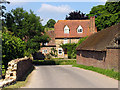
Street: Upper Lambourn
Upper Lambourn occupies the north-west to south-east diagonal through the square. This view of the intersection of the road (running north east off the B road) and the minor road that rejoins the B road, is in the centre of the square. The square is farmland and village.
Image: © Pam Brophy
Taken: 9 Jul 2005
0.12 miles
6
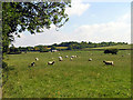
Sheep Farming near Upper Lambourn
The square is farmland and village. This view is of a field in the middle of the southern half of the square, south east of the cemetery.
Image: © Pam Brophy
Taken: 9 Jul 2005
0.12 miles
7

The Malt Shovel Free House in Upper Lambourn
Image: © David McManamon
Taken: 2 Apr 2005
0.14 miles
8

Malt Shovel Lane, Upper Lambourn
The pub and its lane.
Image: © Des Blenkinsopp
Taken: 4 Mar 2013
0.15 miles
9

The Malt Shovel, Upper Lambourn
Once the village bakehouse now one of the favourite watering holes of the racing fraternity. The building is Grade II listed.
Image: © Maigheach-gheal
Taken: 22 Nov 2009
0.16 miles
10

Cottage and byway, Upper Lambourn
The byway is the continuation at the eastern end of the tarmac section of High Street. It's marked on maps as being unrestricted, but there's a post to prevent cars from using it. Horse-riders are asked to use the left-hand track and pedestrians the path to the right.
Image: © Andrew Smith
Taken: 23 Aug 2009
0.18 miles