IMAGES TAKEN NEAR TO
Aintree, HUNGERFORD, RG17 8PQ
Introduction
This page details the photographs taken nearby to Aintree, RG17 8PQ by members of the Geograph project.
The Geograph project started in 2005 with the aim of publishing, organising and preserving representative images for every square kilometre of Great Britain, Ireland and the Isle of Man.

There are currently over 7.5m images from over14,400 individuals and you can help contribute to the project by visiting https://www.geograph.org.uk
Image Map
Images are licensed for reuse under creativecommons.org/licenses/by-sa/2.0
Notes
- Clicking on the map will re-center to the selected point.
- The higher the marker number, the further away the image location is from the centre of the postcode.
Image Listing (166 Images Found)
Images are licensed for reuse under creativecommons.org/licenses/by-sa/2.0
Image
Details
Distance
1
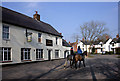
The Lamb
Yet another closed pub.
Right on the line here. Mill Lane, beyond the riders, is in the next square.
Image: © Des Blenkinsopp
Taken: 8 Mar 2011
0.05 miles
2
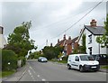
Mill Lane, Lambourn
I have to agree with Des Blenkinsop http://www.geograph.org.uk/photo/2301980 that this is one of those residential streets that could be almost anywhere - at least across the southern half of England.
Image: © Stefan Czapski
Taken: 4 Jun 2017
0.05 miles
3
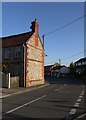
Lambourn: sarsen stone and red brick in Newbury Street
Boulders of sarsen stone can be found on the Lambourn and Marlborough downs - and have been a source of building material since prehistoric times.
Image: © Stefan Czapski
Taken: 10 Oct 2018
0.06 miles
4
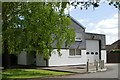
Lambourn Fire Station
Lambourn Fire Station, Newbury Street, Lambourn, Berkshire
Image: © Kevin Hale
Taken: 8 May 2007
0.06 miles
5
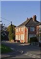
Lambourn: red brick and terracotta in Newbury Street
Effective use made of white brick, too - especially at the corbelled-out corner. The house nudging into the right-hand side of the picture seems to be built of chequered red and yellow brick - but it didn't occur to me to record it.
Image: © Stefan Czapski
Taken: 10 Oct 2018
0.07 miles
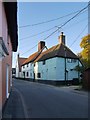
7
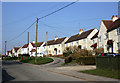
Mill Lane, Lambourn
One of those could be anywhere roads.
Image: © Des Blenkinsopp
Taken: 8 Mar 2011
0.12 miles
8
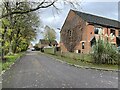
Lambourn railway station (site), Berkshire
Opened in 1898 by the Lambourn Valley Railway, later part of the Great Western Railway, as the terminus of its branch from Newbury, this station closed to passengers in 1960.
View south west from a spot near the buffers, looking along the passenger platform. The track would have been near the pavement. Further to the right was a goods shed and goods yard, now covered by housing.
For more information, see http://www.disused-stations.org.uk/l/lambourn/index.shtml.
Image: © Nigel Thompson
Taken: 10 Nov 2022
0.13 miles
9
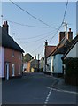
Lambourn: Newbury Street (1)
View north.
Image: © Stefan Czapski
Taken: 10 Oct 2018
0.14 miles