IMAGES TAKEN NEAR TO
Enborne Street, NEWBURY, RG14 6TW
Introduction
This page details the photographs taken nearby to Enborne Street, RG14 6TW by members of the Geograph project.
The Geograph project started in 2005 with the aim of publishing, organising and preserving representative images for every square kilometre of Great Britain, Ireland and the Isle of Man.

There are currently over 7.5m images from over14,400 individuals and you can help contribute to the project by visiting https://www.geograph.org.uk
Image Map
Images are licensed for reuse under creativecommons.org/licenses/by-sa/2.0
Notes
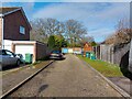
- Clicking on the map will re-center to the selected point.
- The higher the marker number, the further away the image location is from the centre of the postcode.
Image Listing (81 Images Found)
Images are licensed for reuse under creativecommons.org/licenses/by-sa/2.0
Image
Details
Distance
1
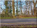
Footpath to Falkland Cricket Club
The footpath across Enborne Street to Falkland Cricket Club and The Bowler's Arms (a pub).
Image: © Oscar Taylor
Taken: 24 Mar 2023
0.04 miles
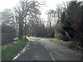
2
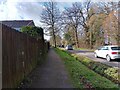
Enborne Street
Looking south on Enborne Street. Lots of cars park along the street as the housing estate at Wash Common has such limited parking, meaning the street is difficult to navigate for cars. A ditch separates the road and footpath.
Image: © Oscar Taylor
Taken: 24 Mar 2023
0.04 miles
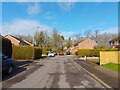
3
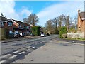
Villiers Way
Looking along Villiers Way towards Enborne Street over the junction to Stapleton Close.
Image: © Oscar Taylor
Taken: 24 Mar 2023
0.06 miles
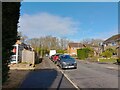
4
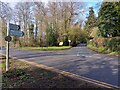
Wheatlands Lane
Looking across Enborne Street to Wheatlands Lane, which passes under the A34.
Image: © Oscar Taylor
Taken: 24 Mar 2023
0.06 miles
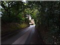
5
Enbourne Street junction with Wheatlands Lane
Image: © Stuart Logan
Taken: 27 Jan 2013
0.06 miles
6
Wheatlands Lane
Wheatlands Lane is a lane off Enborne Street.
Image: © Oscar Taylor
Taken: 26 Apr 2023
0.07 miles
7
Meldrum Close
A cul-de-sac off Balfour Crescent, connected by a "walk" to Enborne Street for pedestrian access.
Image: © Oscar Taylor
Taken: 24 Mar 2023
0.07 miles
8
Villiers Way
A road between Enborne Street and Glendale Avenue.
Image: © Oscar Taylor
Taken: 24 Mar 2023
0.08 miles
9
Access road to garages
A road used for access to garages off Stapleton Close.
Image: © Oscar Taylor
Taken: 24 Mar 2023
0.08 miles
10
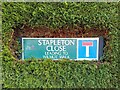
Stapleton Close sign
A sign for Stapleton Close, submurged in a hedge.
Image: © Oscar Taylor
Taken: 24 Mar 2023
0.08 miles