
IMAGES TAKEN NEAR TO
Wansey Gardens, NEWBURY, RG14 2SJ
Introduction
This page details the photographs taken nearby to Wansey Gardens, RG14 2SJ by members of the Geograph project.
The Geograph project started in 2005 with the aim of publishing, organising and preserving representative images for every square kilometre of Great Britain, Ireland and the Isle of Man.

There are currently over 7.5m images from over14,400 individuals and you can help contribute to the project by visiting https://www.geograph.org.uk
Image Map
Images are licensed for reuse under creativecommons.org/licenses/by-sa/2.0
Notes
- Clicking on the map will re-center to the selected point.
- The higher the marker number, the further away the image location is from the centre of the postcode.
Image Listing (13 Images Found)
Images are licensed for reuse under creativecommons.org/licenses/by-sa/2.0
Image
Details
Distance
1
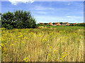
Clay Hill: Housing Estate
This housing estate is surrounded by open land which is seen between the houses and the minor road, in the top of the south eastern section of the square. This view is on a bearing of more or less east from near the minor road.
Image: © Pam Brophy
Taken: 9 Aug 2005
0.09 miles

3
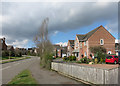
Waller Drive, Shaw
Recently built residential area on the northern edge of Newbury.
Image: © Des Blenkinsopp
Taken: 5 Apr 2016
0.12 miles
4
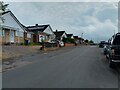
Wyndham Road, Newbury
Wyndham Road is a road between Stoney Lane and Turnpike Road in Newbury. This area is dominated by bungalows.
Image: © Oscar Taylor
Taken: 20 Jun 2023
0.12 miles
5
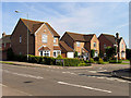
Residential Street: near Shaw
This street is typical of those in the newer housing estates seen in this square, particularly on the east side of the square.
Image: © Pam Brophy
Taken: 9 Aug 2005
0.16 miles
6
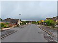
Wyndham Road towards Stoney Lane, Newbury
Looking from Wyndham Road towards Stoney Lane in Newbury. This area is dominated by bungalows.
Image: © Oscar Taylor
Taken: 20 Jun 2023
0.16 miles
7
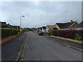
Clay Hill Crescent, Newbury
Clay Hill Crescent is a road connecting to Wyndham Road in two places. In the distance is Fennel Close, a cul-de-sac. This area is dominated by bungalows.
Image: © Oscar Taylor
Taken: 20 Jun 2023
0.16 miles
8
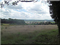
Rough land to the south of Stoney Lane
High above the Kennet Valley that cradles Newbury and Thatcham lies this brief remnant of open countryside. In the distance can be seen the main grandstand of Newbury Racecourse.
Image: © Stuart Logan
Taken: 7 Jul 2011
0.22 miles
9

Edgehill Close & Huntington Gardens
Recently built residential streets on the northern edge of Newbury.
Image: © Des Blenkinsopp
Taken: 5 Apr 2016
0.22 miles
