
IMAGES TAKEN NEAR TO
Cheviot Drive, READING, RG10 9QD
Introduction
This page details the photographs taken nearby to Cheviot Drive, RG10 9QD by members of the Geograph project.
The Geograph project started in 2005 with the aim of publishing, organising and preserving representative images for every square kilometre of Great Britain, Ireland and the Isle of Man.

There are currently over 7.5m images from over14,400 individuals and you can help contribute to the project by visiting https://www.geograph.org.uk
Image Map
Images are licensed for reuse under creativecommons.org/licenses/by-sa/2.0
Notes
- Clicking on the map will re-center to the selected point.
- The higher the marker number, the further away the image location is from the centre of the postcode.
Image Listing (18 Images Found)
Images are licensed for reuse under creativecommons.org/licenses/by-sa/2.0
Image
Details
Distance
2

Charvil Meadows
In a field just north of the A3032. Towards the right side of the picture you can just see this gap in the hedgerow http://www.geograph.org.uk/photo/987634 .
Image: © Andrew Smith
Taken: 20 Sep 2008
0.14 miles
3

Charvil Meadows
The passageway between two fields immediately north of the A3032 on a typical autumn morning.
Image: © Andrew Smith
Taken: 20 Sep 2008
0.14 miles
4

Hogweed, Charvil Meadows
The seed heads of this very common umbellifer helping to support a spider's web.
Image: © Andrew Smith
Taken: 20 Sep 2008
0.14 miles
5
Junction of Park View Drive South with Old Bath Road
Image: © Shazz
Taken: 17 Aug 2013
0.16 miles
6
Charvil Meadows
A nature reserve on the Loddon floodplain.
Image: © Andrew Smith
Taken: 22 Jul 2007
0.19 miles
7
Charvil Meadows
Boxing Day dawned to a touch of mist and frost - a contrast to this atypical summer version: Image
Image: © Andrew Smith
Taken: 26 Dec 2007
0.19 miles
8
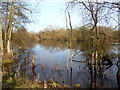
Old Gravel Pit, Charvil
One of several gravel pit lakes in this area. Now part of Loddon Nature Reserve.
Image: © Des Blenkinsopp
Taken: 18 Feb 2013
0.19 miles
9
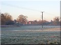
Charvil Meadows
With a glimpse of the modern houses on the eastern edge of the village.
Image: © Andrew Smith
Taken: 11 Feb 2008
0.20 miles
10
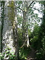
Trees on the footpath
The footpath follows the western boundary of the industrial estate. Here are two very large trees, much larger than I would expect for a low lying area with a river nearby. Identification please.
Image: © Graham Horn
Taken: 1 Aug 2011
0.21 miles