1
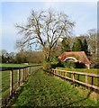
Frosty morning, Holly Cross
Looking northwest from the road junction.
Image: © Andrew Smith
Taken: 18 Nov 2005
0.02 miles
2
Gate House, Cayton Park
Image: © Des Blenkinsopp
Taken: 15 Feb 2013
0.04 miles
3
The entrance to Cayton Park
Image: © Andrew Smith
Taken: 18 Nov 2005
0.04 miles
4
Gates to Cayton Park
Gates to Cayton Park with to the right Restricted Byway of Hatch Gate Lane
Image: © Shaun Ferguson
Taken: 12 Jun 2009
0.06 miles
5
Paddocks, Holly Cross
Looking towards the crossroads on Warren Row Road. Smart wooden fences are typical of the Juddmonte Farms.
Image: © Andrew Smith
Taken: 8 Apr 2008
0.10 miles
6
Footpath, Holly Cross, Berkshire
Image: © Oswald Bertram
Taken: 28 Dec 2015
0.11 miles
7
The Horns, Cockpole Green
More of a general view than a good picture of the pub itself, due to the frontage being cluttered with cars.
Image: © Des Blenkinsopp
Taken: 15 Feb 2013
0.17 miles
8
The Horns Inn, Crazies Hill, Berkshire
Late C16 with C19 and C2O alterations. Timber framed with painted brick infilling, part weatherboarded. Old tile roof, flanking chimneys. 4 framed bays. One and 2 storeys. South-east elevation: 2 bays C19 2-light casement windows with horizontal glazing bars on first floor with small gables breaking eaves: central entrance door on ground floor under board hood on brackets, antlers attached to carved wood skull fixed to wall above, C19 similar casements to left of door and 3-light to right. C19 single storey extension from right hand gable, former barn adjoining left hand gable part weatherboarded with one arch brace visible and one 5-light casement window on ground floor. Interior contains some exposed framing.
(Source:Historic England)
Image: © Oswald Bertram
Taken: 28 Dec 2015
0.19 miles
9
Former Crazies Hill Mission Church
Erected in 1907. Now used as the Village Hall.
Image: © Michael FORD
Taken: Unknown
0.20 miles
10
Crazies Hill Village Hall
Originally built as a mission church and still containing an altar.
According to the village website https://sites.google.com/site/crazieshill/about-our-villages one explanation for the village name is the Old English word for buttercups, "cragies" or "crazies".
Image: © Des Blenkinsopp
Taken: 15 Feb 2013
0.20 miles


