IMAGES TAKEN NEAR TO
Cotterell Gardens, READING, RG10 0XP

Introduction

This page details the photographs taken nearby to Cotterell Gardens, RG10 0XP by members of the Geograph project.

The Geograph project started in 2005 with the aim of publishing, organising and preserving representative images for every square kilometre of Great Britain, Ireland and the Isle of Man.

There are currently over 7.5m images from over14,400 individuals and you can help contribute to the project by visiting https://www.geograph.org.uk

Image Map


Images are licensed for reuse under creativecommons.org/licenses/by-sa/2.0
Notes
  • Clicking on the map will re-center to the selected point.
  • The higher the marker number, the further away the image location is from the centre of the postcode.

Image Listing (16 Images Found)

Images are licensed for reuse under creativecommons.org/licenses/by-sa/2.0
Image
Details
Distance
1
Spring daffs' in Broad Hinton
Taken facing west approx one hour before sun-down
Image: © Peter Goodwin Taken: 7 Mar 2007
0.09 miles
2
Broad Hinton, Twyford
The modern housing on the southern fringe of Twyford. The estate's main road is named after the fact that Twyford and Hurst were formerly within the liberty of Broad Hinton, Wiltshire.
Image: © Andrew Smith Taken: 2 Nov 2007
0.09 miles
3
Stanlake Bridge
The bridge has this old Berkshire County Council bridge plate on it, bridge number 179.
Image: © Graham Horn Taken: 1 Aug 2011
0.09 miles
4
On the path to Stanlake Bridge
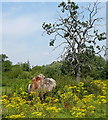
A on old, sick tree, a fallen dead tree and ragwort in profusion make up a scene from the footpath to Stanlake Bridge. Why is there so much ragwort this year?
Image: © Graham Horn Taken: 1 Aug 2011
0.10 miles
5
Ponies near Stanlake Bridge
They were trying to get some shade from the bright sunshine in their paddock. The footpath goes past that tree. We gave them a wide berth, but they were not interested in us.
Image: © Graham Horn Taken: 1 Aug 2011
0.13 miles
6
Ponies near Stanlake Bridge
They were trying to get some shade from the bright sunshine in their paddock. The footpath goes past that tree. We gave them a wide berth, but they were not interested in us.
Image: © Graham Horn Taken: 1 Aug 2011
0.13 miles
7
Stanlake Meadow
Stanlake Meadow - looking North from close to the entrance to what is now a large Playing field, and Community recreation area.
Image: © Colin Bates Taken: 17 Oct 2005
0.17 miles
8
Track to Stanlake Manor
This is a private estate track towards the manor, which is in Image The estate is now home to a vineyard.
Image: © Graham Horn Taken: 1 Aug 2011
0.18 miles
9
Kissing gates in profusion
There is a policy in this area of replacing a lot of stiles with kissing gates to allow disabled access. These are the type, installed by volunteers from the local Ramblers' group, and these were not the only two along this footpath. Used literally, walking with the right companion can be a pleasurable experience.
Image: © Graham Horn Taken: 1 Aug 2011
0.19 miles
10
Houses near Stanlake Manor
On the edge of Tyford.
Image: © James Emmans Taken: 31 May 2017
0.19 miles