
IMAGES TAKEN NEAR TO
Virginia Street, SOUTHPORT, PR8 6SJ
Introduction
This page details the photographs taken nearby to Virginia Street, PR8 6SJ by members of the Geograph project.
The Geograph project started in 2005 with the aim of publishing, organising and preserving representative images for every square kilometre of Great Britain, Ireland and the Isle of Man.

There are currently over 7.5m images from over14,400 individuals and you can help contribute to the project by visiting https://www.geograph.org.uk
Image Map
Images are licensed for reuse under creativecommons.org/licenses/by-sa/2.0
Notes
- Clicking on the map will re-center to the selected point.
- The higher the marker number, the further away the image location is from the centre of the postcode.
Image Listing (62 Images Found)
Images are licensed for reuse under creativecommons.org/licenses/by-sa/2.0
Image
Details
Distance
1
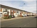
Terraced houses, Virginia Street, Southport
A long line of terraced houses on Virginia Street in Southport.
Image: © Graham Robson
Taken: 24 Mar 2018
0.02 miles
2
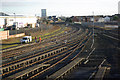
Railway at Southport
The line to Wigan and Manchester curves out of Southport with some semi-dismantled carriage sidings in the foreground. On the left, where the retail building now is, was once the site of Southport's Central station which had a very short life as a passenger station - closing in 1901 - but continued to handle goods into the 1970s.
Image: © Stephen McKay
Taken: 10 Dec 2008
0.07 miles
3
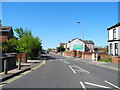
Virginia Street, Southport
Heading southwest towards the Eastbank Street, Scarisbrick New Road and St. James Street roundabout.
Image: © John Topping
Taken: 25 May 2013
0.07 miles
4
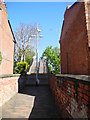
Steps to Victoria Bridge
Approaching from Victoria Bridge Road.
Image: © John Topping
Taken: 25 May 2013
0.10 miles
5
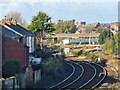
Victoria footbridge
A somewhat distant view of Victoria footbridge seen from the Windsor Road footbridge. The live rails carry the Manchester to Southport service.
Image: © Oliver Dixon
Taken: 22 Oct 2024
0.11 miles
6
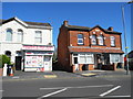
Virginia Street, Mini Mart
General store and Off licence. Ex Oakland Villas 1875.
Image: © John Topping
Taken: 25 May 2013
0.12 miles
8
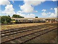
Southport Railway Yard
Merseyrail electric unit 507019 is parked beneath the footbridge, which crosses the yard, and the diesel line to Wigan, just outside Southport railway station.
Image: © El Pollock
Taken: 13 Jun 2012
0.13 miles
9
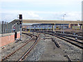
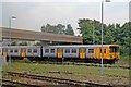
Footbridge and sidings outside Chapel Street station
The same class 507/508 units are in the sidings as in my view from 30 years earlier Image but the semaphore signals have been replaced with colour lights, and the industrial buildings beyond replaced with housing.
Image: © Stephen Craven
Taken: 24 Mar 2018
0.13 miles
10
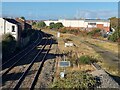
Railway west of Windsor Road foobridge
The live rails now only carry the Manchester to Southport service. From this point, the tracks originally fanned out to lines to Chapel Street station, the goods yard and Southport Central station (later Derby Road goods station). The area of the latter two is now occupied by the M Park Central 12 shopping centre (seen on the right) and adjoining car park. It is just possible to make out the Victoria footbridge in the distance.
Image: © Oliver Dixon
Taken: 22 Oct 2024
0.14 miles