Railway at Southport
Introduction
The photograph on this page of Railway at Southport by Stephen McKay as part of the Geograph project.
The Geograph project started in 2005 with the aim of publishing, organising and preserving representative images for every square kilometre of Great Britain, Ireland and the Isle of Man.

There are currently over 7.5m images from over 14,400 individuals and you can help contribute to the project by visiting https://www.geograph.org.uk
Railway at Southport
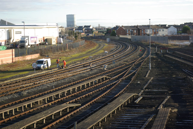
Image: © Stephen McKay Taken: 10 Dec 2008
The line to Wigan and Manchester curves out of Southport with some semi-dismantled carriage sidings in the foreground. On the left, where the retail building now is, was once the site of Southport's Central station which had a very short life as a passenger station - closing in 1901 - but continued to handle goods into the 1970s.
Images are licensed for reuse under creativecommons.org/licenses/by-sa/2.0
Image Location
Latitude
53.644089
Longitude
-2.997264