IMAGES TAKEN NEAR TO
Boundary Brook Drive, PR8 5FF
Introduction
This page details the photographs taken nearby to Boundary Brook Drive, PR8 5FF by members of the Geograph project.
The Geograph project started in 2005 with the aim of publishing, organising and preserving representative images for every square kilometre of Great Britain, Ireland and the Isle of Man.

There are currently over 7.5m images from over14,400 individuals and you can help contribute to the project by visiting https://www.geograph.org.uk
Image Map
Images are licensed for reuse under creativecommons.org/licenses/by-sa/2.0
Notes
- Clicking on the map will re-center to the selected point.
- The higher the marker number, the further away the image location is from the centre of the postcode.
Image Listing (26 Images Found)
Images are licensed for reuse under creativecommons.org/licenses/by-sa/2.0
Image
Details
Distance
1
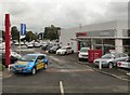
Nowhere Cars
This Honda car dealership is on the site of a Garden centre and cafe known as "Nowhere".
Image: © Gerald England
Taken: 16 Jul 2010
0.03 miles
2
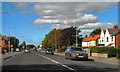
Southport Road (A570) Approaching Boundary Bridge
Southport Road, approaching Boundary Bridge where it crosses Boundary Brook, entering Southport and changing its name to Sacrisbrick Road.
Image: © David Dixon
Taken: 25 Sep 2010
0.07 miles
4
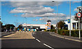
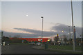
Scarisbrick New Road (A570)
Approaching the roundabout for Kew Retail Park.
Image: © David Dixon
Taken: 25 Sep 2010
0.10 miles
5
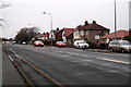
Scarisbrick New Road
The edge of Scarisbrick near the boundary with Southport.
Image: © Mike Pennington
Taken: 22 Dec 2015
0.10 miles
6
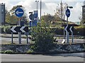
Foul Lane roundabout
Roundabout on the busy A570 which gives access to the various retail and trading estates in the vicinity. The roundabout stands on the site of a former railway bridge on the Barton Branch railway. In the background is the last remaining fragment of railway embankment Image For details about the railway at this point, see Image
Image: © Oliver Dixon
Taken: 22 Oct 2024
0.10 miles
7
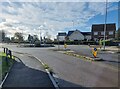
Foul Lane roundabout
Roundabout on the busy A570 which gives access to the various retail and trading estates in the vicinity. The roundabout stands on the site of a former railway bridge on the Barton Branch railway with the site of Kew Gardens station (closed 1938) this side of the roundabout and just out of view to the right. In the background is the last remaining fragment of railway embankment Image The Old Duke public house stands on the far side of the main road.
Image: © Oliver Dixon
Taken: 22 Oct 2024
0.10 miles
8
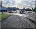
Foul Lane roundabout
Roundabout on the busy A570 which gives access to the various retail and trading estates in the vicinity. The view is taken from the site of Kew Gardens station (closed 1938) on the Barton branch railway which spanned the road immediately this side of the roundabout. The bridge was approached on embankments on both side, now completely obliterated.
Image: © Oliver Dixon
Taken: 22 Oct 2024
0.10 miles
9
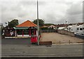
Oriental Delight
Restaurant and a vacant lot on Southport Road.
Image: © Gerald England
Taken: 16 Jul 2010
0.12 miles