
IMAGES TAKEN NEAR TO
Fielding Place, CHORLEY, PR6 9NZ
Introduction
This page details the photographs taken nearby to Fielding Place, PR6 9NZ by members of the Geograph project.
The Geograph project started in 2005 with the aim of publishing, organising and preserving representative images for every square kilometre of Great Britain, Ireland and the Isle of Man.

There are currently over 7.5m images from over14,400 individuals and you can help contribute to the project by visiting https://www.geograph.org.uk
Image Map
Images are licensed for reuse under creativecommons.org/licenses/by-sa/2.0
Notes
- Clicking on the map will re-center to the selected point.
- The higher the marker number, the further away the image location is from the centre of the postcode.
Image Listing (17 Images Found)
Images are licensed for reuse under creativecommons.org/licenses/by-sa/2.0
Image
Details
Distance
1
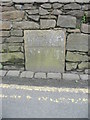
Old Boundary Marker by Babylon Lane, Anderton
Parish Boundary Marker by the UC road, in parish of Anderton (Chorley District), Babylon Lane, Anderton, set in wall, opposite No 124.
Inscription reads:-
BOUNDARY
Surveyed
Milestone Society National ID: LA_HCHAND02pb
Image: © Milestone Society
Taken: Unknown
0.04 miles
2

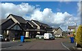
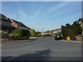
Greenhalgh Lane
This is also a footpath for a route to Rivington
Image: © Kevin Waterhouse
Taken: 28 Jul 2025
0.07 miles
5
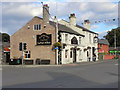
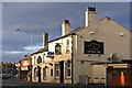
Elephant & Castle
Bolton Road, Adlington.
Image: © David Dixon
Taken: 29 Aug 2010
0.22 miles
7
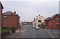
The Elephant and Castle on Bolton Road Adlington
Image: © Raymond Knapman
Taken: 26 Jul 2012
0.22 miles
8
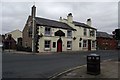
The Elephant and Castle, Adlington
On Bolton Road.
Image: © philandju
Taken: 28 Apr 2013
0.22 miles
9
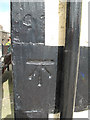
1GL Bolt: Adlington, Elephant and Castle
1GL Bolt: Adlington, Elephant and Castle Mark on corner of the Elephant and Castle Inn ; 3.90 ft. above surface [1GL, Warrington to Adlington, Mark No. 76]; PA BOLT: ELEPHANT AND CASTLE ADLINGTON W ANG SW FACE (ODN 118.1283m, AGL 0.9 m) see http://www.geograph.org.uk/photo/122912 for photograph of the building
Image: © Ian Charters
Taken: 28 Mar 2010
0.22 miles
10
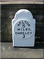
Old Milestone by the A673, Bolton Road, Anderton Parish
Metal plate attached to stone post by the A673, Bolton Road in parish of ANDERTON (CHORLEY District), opposite Supermarket, by No. 18, against wall, on South West side of road. Bolton Plate, erected by the Bolton & Nightingale turnpike trust in the 19th century.
Inscription reads:- : BOLTON / 8 / MILES, / CHORLEY / 3 :
Carved benchmark top.
Milestone Society National ID: LA_BOCY08.
Image: © M Faherty
Taken: 23 Aug 2008
0.23 miles