Old Milestone by the A673, Bolton Road, Anderton Parish
Introduction
The photograph on this page of Old Milestone by the A673, Bolton Road, Anderton Parish by M Faherty as part of the Geograph project.
The Geograph project started in 2005 with the aim of publishing, organising and preserving representative images for every square kilometre of Great Britain, Ireland and the Isle of Man.

There are currently over 7.5m images from over 14,400 individuals and you can help contribute to the project by visiting https://www.geograph.org.uk
Old Milestone by the A673, Bolton Road, Anderton Parish
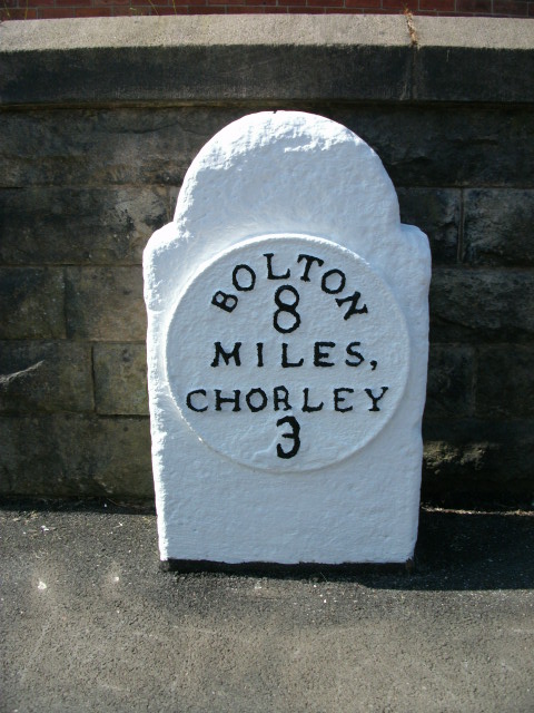
Image: © M Faherty Taken: 23 Aug 2008
Metal plate attached to stone post by the A673, Bolton Road in parish of ANDERTON (CHORLEY District), opposite Supermarket, by No. 18, against wall, on South West side of road. Bolton Plate, erected by the Bolton & Nightingale turnpike trust in the 19th century. Inscription reads:- : BOLTON / 8 / MILES, / CHORLEY / 3 : Carved benchmark top. Milestone Society National ID: LA_BOCY08.
Images are licensed for reuse under creativecommons.org/licenses/by-sa/2.0
Image Location
Latitude
53.616952
Longitude
-2.596382