IMAGES TAKEN NEAR TO
Wham Lane, PRESTON, PR4 4JS
Introduction
This page details the photographs taken nearby to Wham Lane, PR4 4JS by members of the Geograph project.
The Geograph project started in 2005 with the aim of publishing, organising and preserving representative images for every square kilometre of Great Britain, Ireland and the Isle of Man.

There are currently over 7.5m images from over14,400 individuals and you can help contribute to the project by visiting https://www.geograph.org.uk
Image Map
Images are licensed for reuse under creativecommons.org/licenses/by-sa/2.0
Notes
- Clicking on the map will re-center to the selected point.
- The higher the marker number, the further away the image location is from the centre of the postcode.
Image Listing (12 Images Found)
Images are licensed for reuse under creativecommons.org/licenses/by-sa/2.0
Image
Details
Distance
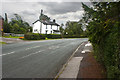
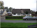
1
Chain House Lane, Whitestake
Whitestake is a small village situated between Farington and New Longton in South Ribble.
Image: © David Dixon
Taken: 12 Jul 2015
0.12 miles
3
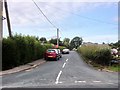
Whitestake, Newgate Lane
Whitestake is a small village situated between Farington and New Longton in the South Ribble district.
Image: © David Dixon
Taken: 12 Jul 2015
0.18 miles
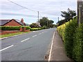
4
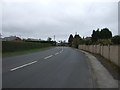
Pope Lane towards White Stake
Looking south east.
Image: © JThomas
Taken: 25 Oct 2018
0.19 miles
7
Whitestake, Chain House Lane
Whitestake is a small village situated between Farington and New Longton in the South Ribble district.
Image: © David Dixon
Taken: 12 Jul 2015
0.22 miles
8
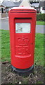
Elizabeth II postbox on Pope Lane, White Stake
Postbox No. PR4 232.
See Image] for wider view.
Image: © JThomas
Taken: 25 Oct 2018
0.22 miles
9
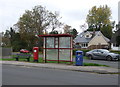
Elizabeth II postbox and bus stop on Pope Lane, White Stake
Postbox No. PR4 232.
See Image] for postbox.
Image: © JThomas
Taken: 25 Oct 2018
0.22 miles
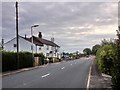
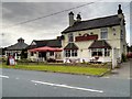
10
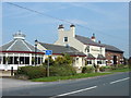
Farmers Arms
on Wham Lane, Whitestake. It's an Inn on the 1940's map but looks as though it was also once a farm, with barn attached.
Image: © Margaret Clough
Taken: 8 May 2006
0.23 miles