
IMAGES TAKEN NEAR TO
Rowan Place, PRESTON, PR4 3FT
Introduction
This page details the photographs taken nearby to Rowan Place, PR4 3FT by members of the Geograph project.
The Geograph project started in 2005 with the aim of publishing, organising and preserving representative images for every square kilometre of Great Britain, Ireland and the Isle of Man.

There are currently over 7.5m images from over14,400 individuals and you can help contribute to the project by visiting https://www.geograph.org.uk
Image Map
Images are licensed for reuse under creativecommons.org/licenses/by-sa/2.0
Notes
- Clicking on the map will re-center to the selected point.
- The higher the marker number, the further away the image location is from the centre of the postcode.
Image Listing (12 Images Found)
Images are licensed for reuse under creativecommons.org/licenses/by-sa/2.0
Image
Details
Distance
1
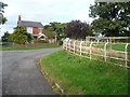
House on the corner, New Hey Lane, Dowbridge
The elegant white iron fence has been supplemented by a more utilitarian wooden post and rail.
Image: © Christine Johnstone
Taken: 5 Oct 2015
0.06 miles
2
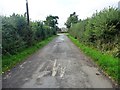
Slow on New Hey Lane
A sharp bend and a speed limit on cycle route 62, heading west to Dowbridge.
Image: © Christine Johnstone
Taken: 5 Oct 2015
0.08 miles
3
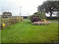
Corner of Blackpool Road and Newhay Lane
Image: © Gerald England
Taken: 28 Aug 2016
0.09 miles
4
![Blackpool Road [B5192]](https://s1.geograph.org.uk/geophotos/04/69/01/4690117_a25cc78e_120x120.jpg)
Blackpool Road [B5192]
Looking west to a 12 metre spot height at Dowbridge.
Image: © Christine Johnstone
Taken: 5 Oct 2015
0.11 miles
5
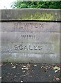
Old Boundary Marker by the B5192, Dowbridge, Kirkham parish
Parish Boundary Marker by the B5192, in parish of Kirkham (Fylde District), Dowbridge, on Southeast corner of the parapet.
Inscription reads:-
NEWTON
WITH
SCALES
Surveyed
Milestone Society National ID: LA_BPPS10pb
Image: © Milestone Society
Taken: Unknown
0.11 miles
6

Dowbridge at Dowbridge
Carrying the Blackpool Road over Dow Brook. The northern [visible] parapet is inscribed 'CCDOWBRIDGE'.
Image: © Christine Johnstone
Taken: 5 Oct 2015
0.11 miles
7
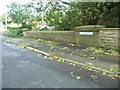
Kirkham boundary sign, Blackpool Road, Dowbridge
Dow Brook is a parish boundary. The west pillar on the bridge's southern parapet is inscribed 'Kirkham', the east pier 'Newton-with-Scales'.
Image: © Christine Johnstone
Taken: 5 Oct 2015
0.12 miles
8
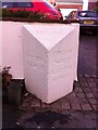
Old Milestone by the B5192, Dowbridge, Kirkham Parish
Carved stone post by the B5192, in parish of KIRKHAM (FYLDE District), Preston Road, Dowbridge; opposite Glebe Lane, by No. 73, by the road, on North side of road. Lancashire CC stone triangle, erected by the County Council in the 19th/20th century.
Inscription reads:- : PRESTON / 7¾ MILES : : KIRKHAM : : KIRKHAM / ¾ MILE / BLACKPOOL / 10 MILES :
Milestone Society National ID: LA_BPPS10.
Image: © C Marcus
Taken: 1 Apr 2008
0.16 miles
9
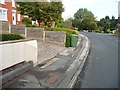
Kirkham milestone, B5192, from the west
'Preston 7 3/4 miles'. Well preserved, but painted to match the garden wall.
Image: © Christine Johnstone
Taken: 5 Oct 2015
0.16 miles
10
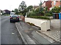
Kirkham milestone, B5192, from the east
'Kirkham 3/4 mile, Blackpool 10 miles'. Well preserved, but painted to blend in with the garden wall behind.
Image: © Christine Johnstone
Taken: 5 Oct 2015
0.17 miles