
IMAGES TAKEN NEAR TO
Leathercote, PRESTON, PR3 1QT
Introduction
This page details the photographs taken nearby to Leathercote, PR3 1QT by members of the Geograph project.
The Geograph project started in 2005 with the aim of publishing, organising and preserving representative images for every square kilometre of Great Britain, Ireland and the Isle of Man.

There are currently over 7.5m images from over14,400 individuals and you can help contribute to the project by visiting https://www.geograph.org.uk
Image Map
Images are licensed for reuse under creativecommons.org/licenses/by-sa/2.0
Notes
- Clicking on the map will re-center to the selected point.
- The higher the marker number, the further away the image location is from the centre of the postcode.
Image Listing (127 Images Found)
Images are licensed for reuse under creativecommons.org/licenses/by-sa/2.0
Image
Details
Distance
1
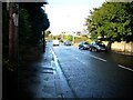
The B6340 road in Garstang.
The road is running past St. Mary's and St. Michaels' Church, completely hidden by the trees on the right of the photograph.
Image: © James Denham
Taken: 27 Oct 2008
0.08 miles
4
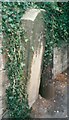
Old Boundary Marker by the B6430, Bond's Lane
Parish Boundary Marker by the B6430 (was A6), in parish of Barnacre with Bonds (Wyre District), Bond's Lane; by No 24 at end of boundary wall, in pavement with back to stone boundary wall, West side of road.
Surveyed
Milestone Society National ID: LA_PSGS10pb
Image: © Milestone Society
Taken: Unknown
0.08 miles
5
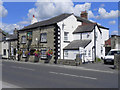
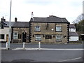
Church Inn
The Church Inn, on Bonds Lane at Garstang was originally called the Rose and Crown. It was given its present name in 1858 in recognition of the building of the new Catholic Church nearby (Image] ). It had been a pair of houses until around the 1790s, when it began to be used as an ale house - probably to serve the Irish navvies (http://en.wikipedia.org/wiki/Navvy ) who worked on the building of the Lancaster Canal.
Image: © David Dixon
Taken: 26 Jul 2011
0.09 miles
6
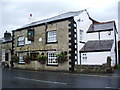
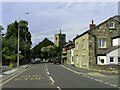
The Church Inn, Bonds lane, Garstang
Image: © Alexander P Kapp
Taken: 3 Sep 2008
0.10 miles
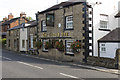
8
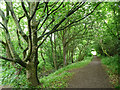
Path, Garstang
Short stretch of the Wyre Way by the river.
Image: © Stephen Richards
Taken: 12 Jun 2013
0.10 miles
9
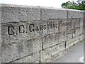
Inscription on Garstang Bridge
The bridge was built in the early 19C, and widened on the north-east side in the 20C. It has two segmental arches and central triangular cutwaters with pedestrian refuges above them. It seems that Lancashire bridges often have the name of the bridge inscribed on them. In this case the word 'Lancashire' before 'C.C.' has been lost, presumably when the bridge was widened.
Image: © Humphrey Bolton
Taken: 14 May 2007
0.10 miles
10
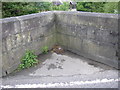
Boundary inscription on Garstang Bridge
Barnacre with Bonds on the left (no doubt these were once separate townships, but were established as a joint civil parish in 1866); Garstang on the right. The photograph shows the central pedestrian refuge, built on top of the cutwater.
Image: © Humphrey Bolton
Taken: 14 May 2007
0.10 miles