IMAGES TAKEN NEAR TO
Garstang Road, PRESTON, PR3 0TD
Introduction
This page details the photographs taken nearby to Garstang Road, PR3 0TD by members of the Geograph project.
The Geograph project started in 2005 with the aim of publishing, organising and preserving representative images for every square kilometre of Great Britain, Ireland and the Isle of Man.

There are currently over 7.5m images from over14,400 individuals and you can help contribute to the project by visiting https://www.geograph.org.uk
Image Map (Loading...)


Getting Data...Please wait
Leaflet Map data © OpenStreetMap
Images are licensed for reuse under creativecommons.org/licenses/by-sa/2.0
Notes
- Clicking on the map will re-center to the selected point.
- The higher the marker number, the further away the image location is from the centre of the postcode.
Image Listing (10 Images Found)
Images are licensed for reuse under creativecommons.org/licenses/by-sa/2.0
Image
Details
Distance
1
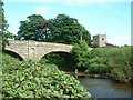
St Michael's Bridge & Church
The river is the Wyre
Image: © David Medcalf
Taken: 11 Jun 2005
0.02 miles
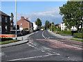
2
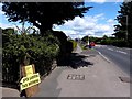
Garstang Road through St Michael's on Wyre
Image: © Steve Daniels
Taken: 27 Aug 2014
0.12 miles
3
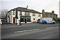
Not Now Convenience
This fishing shop has just taken over from the village convenience store.
Image: © Bob Jenkins
Taken: 17 Mar 2009
0.12 miles
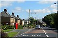
4
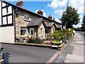
Garstang Road, St. Michael's on Wyre
Several gardens in St Michael's on Wyre were opened for the charity National Garden Scheme (NGS) http://www.ngs.org.uk/
Image: © Norman Caesar
Taken: 29 Jun 2014
0.13 miles

7
Garstang Road St. Michael's on Wyre
8 gardens in the village of St. Michael's on Wyre were opened for the charity National Garden Scheme (NGS) http://www.ngs.org.uk/
Image: © Norman Caesar
Taken: 29 Jun 2014
0.22 miles
8
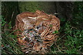
St. Michael's: fungus on a dead tree by a footpath near the river
Image: © Chris
Taken: 30 Jul 2014
0.23 miles
9
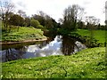
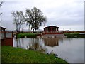
River Wyre
A view down the River Wyre from a footpath near St Michael's on Wyre.
Image: © Rude Health
Taken: 11 Apr 2014
0.24 miles