IMAGES TAKEN NEAR TO
Tarngate Mews, PRESTON, PR3 0EU
Introduction
This page details the photographs taken nearby to Tarngate Mews, PR3 0EU by members of the Geograph project.
The Geograph project started in 2005 with the aim of publishing, organising and preserving representative images for every square kilometre of Great Britain, Ireland and the Isle of Man.

There are currently over 7.5m images from over14,400 individuals and you can help contribute to the project by visiting https://www.geograph.org.uk
Image Map (Loading...)


Getting Data...Please wait
Leaflet Map data © OpenStreetMap
Images are licensed for reuse under creativecommons.org/licenses/by-sa/2.0
Notes
- Clicking on the map will re-center to the selected point.
- The higher the marker number, the further away the image location is from the centre of the postcode.
Image Listing (8 Images Found)
Images are licensed for reuse under creativecommons.org/licenses/by-sa/2.0
Image
Details
Distance
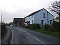
3

Great Eccleston Bowling Club, Hall Lane
The village of Great Eccleston is situated on the Fylde coastal plain, south of the River Wyre, approximately 10 miles upstream from Fleetwood. It is listed in the 1086 Domesday Book as Eglestun.
Image: © David Dixon
Taken: 16 Nov 2019
0.14 miles
4
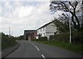
Hall Lane
Hall Lane leading into Great Eccleston.
Image: © Peter McDermott
Taken: 8 Oct 2016
0.20 miles


7
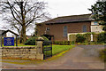
Great Eccleston, St Mary's Roman Catholic Church
The village of Great Eccleston is situated on the Fylde coastal plain, south of the River Wyre, approximately 10 miles upstream from Fleetwood. It is listed in the 1086 Domesday Book as Eglestun.
Image: © David Dixon
Taken: 16 Nov 2019
0.24 miles
8
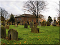
St Mary's RC Church, Great Eccleston
The village of Great Eccleston is situated on the Fylde coastal plain, south of the River Wyre, approximately 10 miles upstream from Fleetwood. It is listed in the 1086 Domesday Book as Eglestun.
Image: © David Dixon
Taken: 16 Nov 2019
0.24 miles