IMAGES TAKEN NEAR TO
Crematorium Avenue, PRESTON, PR2 5BY
Introduction
This page details the photographs taken nearby to Crematorium Avenue, PR2 5BY by members of the Geograph project.
The Geograph project started in 2005 with the aim of publishing, organising and preserving representative images for every square kilometre of Great Britain, Ireland and the Isle of Man.

There are currently over 7.5m images from over14,400 individuals and you can help contribute to the project by visiting https://www.geograph.org.uk
Image Map
Images are licensed for reuse under creativecommons.org/licenses/by-sa/2.0
Notes
- Clicking on the map will re-center to the selected point.
- The higher the marker number, the further away the image location is from the centre of the postcode.
Image Listing (10 Images Found)
Images are licensed for reuse under creativecommons.org/licenses/by-sa/2.0
Image
Details
Distance
1
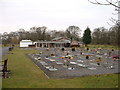
Preston Crematorium
In the old grounds of "Red Scar Mansion" and now surrounded by industrial estates.
Image: © David Medcalf
Taken: 11 Mar 2006
0.09 miles

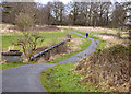
5
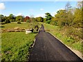
Guild Wheel Cycle Route During Construction
Preston's Guild Wheel Cycle route was constructed and finished during 2012. It is 21 miles long, circling around Preston. This part of the route is the path linking Preston Crematorium to the Ribble Way. Where you are cycling well above the River Ribble.
Image: © Rude Health
Taken: 16 May 2012
0.17 miles
6
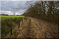
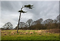
The Ribble Way
The river is to the right, beyond the woods, at a much lower level
Image: © Ian Greig
Taken: 21 Feb 2014
0.18 miles
8
Ribble Way approaching Red Scar Wood
Hard surface path takes the long distance footpath to Red Scar Woods, which then follows the edge of the trees.
The woods conceal very steep banks that slide down to the River Ribble far below.
Image: © Chris Heaton
Taken: 11 Jun 2022
0.22 miles
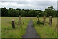
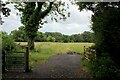
9
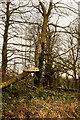
Footpath junction at Red Scar Wood
The footpath towards Red Scar continues straight ahead along the old fence line. The Ribble Way turns slightly right after the stile .
Image: © John Slater
Taken: 30 Apr 2013
0.23 miles
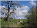
10
Ribble Way near Roman Road Farm
The long distance farm takes a sharp right here, before heading towards Red Scar Woods
Image: © Chris Heaton
Taken: 11 Jun 2022
0.24 miles