IMAGES TAKEN NEAR TO
Quay Point, Northarbour Road, PORTSMOUTH, PO6 3TD
Introduction
This page details the photographs taken nearby to Quay Point, Northarbour Road, PO6 3TD by members of the Geograph project.
The Geograph project started in 2005 with the aim of publishing, organising and preserving representative images for every square kilometre of Great Britain, Ireland and the Isle of Man.

There are currently over 7.5m images from over14,400 individuals and you can help contribute to the project by visiting https://www.geograph.org.uk
Image Map
Images are licensed for reuse under creativecommons.org/licenses/by-sa/2.0
Notes
- Clicking on the map will re-center to the selected point.
- The higher the marker number, the further away the image location is from the centre of the postcode.
Image Listing (81 Images Found)
Images are licensed for reuse under creativecommons.org/licenses/by-sa/2.0
Image
Details
Distance
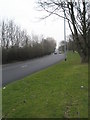
2
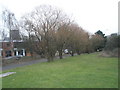
Winter trees between Western and North Harbour Roads
Image: © Basher Eyre
Taken: 24 Feb 2009
0.04 miles
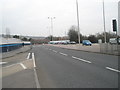
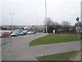
3
Junction of Southampton and Western Roads
Image: © Basher Eyre
Taken: 24 Feb 2009
0.05 miles
4
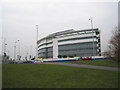
Superb new building as seen from Western Road
Image: © Basher Eyre
Taken: 24 Feb 2009
0.05 miles
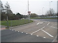
6
Cycleways at the junction of Southampton and Western Roads
Image: © Basher Eyre
Taken: 24 Feb 2009
0.06 miles
7
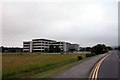
IBM offices at North Harbour
Situated on a strip of land between the A27 and M27, IBM have a large office complex here.
Image: © Martyn Pattison
Taken: 2 Jul 2005
0.06 miles
9
Looking along Western Road towards The Marriott
Image: © Basher Eyre
Taken: 24 Feb 2009
0.06 miles
10
Western end of Medina Road
Taken approaching the footpath onto the Southampton Road (no road access for cars).
Image: © Basher Eyre
Taken: 19 Jan 2008
0.06 miles