IMAGES TAKEN NEAR TO
Tankerton Close, PORTSMOUTH, PO6 3JT
Introduction
This page details the photographs taken nearby to Tankerton Close, PO6 3JT by members of the Geograph project.
The Geograph project started in 2005 with the aim of publishing, organising and preserving representative images for every square kilometre of Great Britain, Ireland and the Isle of Man.

There are currently over 7.5m images from over14,400 individuals and you can help contribute to the project by visiting https://www.geograph.org.uk
Image Map
Images are licensed for reuse under creativecommons.org/licenses/by-sa/2.0
Notes
- Clicking on the map will re-center to the selected point.
- The higher the marker number, the further away the image location is from the centre of the postcode.
Image Listing (182 Images Found)
Images are licensed for reuse under creativecommons.org/licenses/by-sa/2.0
Image
Details
Distance
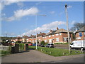
1
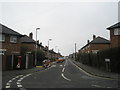
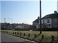
Whitstable Road
Taken on a gloomy and decidedly chilly January morning.
Image: © Basher Eyre
Taken: 19 Jan 2008
0.04 miles
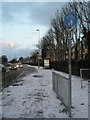
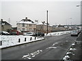
3
Looking southwards down Wymering Lane towards Hookley Close
Image: © Basher Eyre
Taken: 23 Apr 2008
0.06 miles
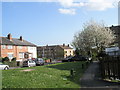
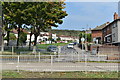
4
Looking along Herne Road to Wymering Methodist Church Centre
Image: © Basher Eyre
Taken: 3 Feb 2009
0.07 miles
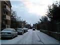
5
Looking from Wymering Lane down towards Clacton Road
Image: © Basher Eyre
Taken: 1 Jul 2009
0.07 miles
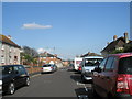
6
View across Southampton Road into Wymering Lane
Image: © David Martin
Taken: 16 Sep 2020
0.07 miles
7
Junction of Sudbury Road and Wymering Lane
Image: © Basher Eyre
Taken: 2 Feb 2009
0.07 miles
8
Looking along Clacton Road to Wymering Lane
Image: © Basher Eyre
Taken: 23 Apr 2008
0.07 miles
9
Junction of Clacton Road and Wymering Lane
Image: © Basher Eyre
Taken: 23 Apr 2008
0.08 miles
10

Postbox on the corner of Wymering Lane and Sudbury Road
Image: © Basher Eyre
Taken: 1 Jul 2009
0.08 miles