IMAGES TAKEN NEAR TO
Plymouth Street, SOUTHSEA, PO5 4JN
Introduction
This page details the photographs taken nearby to Plymouth Street, PO5 4JN by members of the Geograph project.
The Geograph project started in 2005 with the aim of publishing, organising and preserving representative images for every square kilometre of Great Britain, Ireland and the Isle of Man.

There are currently over 7.5m images from over14,400 individuals and you can help contribute to the project by visiting https://www.geograph.org.uk
Image Map
Images are licensed for reuse under creativecommons.org/licenses/by-sa/2.0
Notes
- Clicking on the map will re-center to the selected point.
- The higher the marker number, the further away the image location is from the centre of the postcode.
Image Listing (351 Images Found)
Images are licensed for reuse under creativecommons.org/licenses/by-sa/2.0
Image
Details
Distance
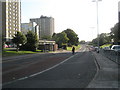
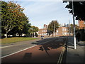
1

Waiting for the Cup Parade in Winston Churchill Avenue
Image: © Basher Eyre
Taken: 18 May 2008
0.03 miles
3

Footbridge over Winston Churchill Avenue
Image: © Steve Daniels
Taken: 30 Apr 2014
0.04 miles
4

The Cabman's Rest in Hyde Park Road
Sadly now closed http://www.portsmouthpubs.org.uk/pubscd.html
Image: © Basher Eyre
Taken: 1 Oct 2008
0.04 miles
5
Approaching the junction of Tyseley Road and Hyde Park Road
Image: © Basher Eyre
Taken: 10 Mar 2011
0.05 miles
6
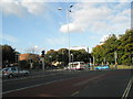
Traffic lights at the Winston Churchill Roundabout
Image: © Basher Eyre
Taken: 1 Oct 2008
0.05 miles

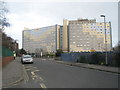
8

Somerstown Hub bridge, Portsmouth
Built in 2013 over Winston Churchill Avenue
Image: © Paul Gillett
Taken: 19 Feb 2014
0.06 miles
9
Lone cyclist in Winston Churchill Avenue
Image: © Basher Eyre
Taken: 1 Oct 2008
0.06 miles
10
Motorbike coming round the Winston Churchill Roundabout
Image: © Basher Eyre
Taken: 1 Oct 2008
0.07 miles