IMAGES TAKEN NEAR TO
Clittaford Road, PLYMOUTH, PL6 6DW
Introduction
This page details the photographs taken nearby to Clittaford Road, PL6 6DW by members of the Geograph project.
The Geograph project started in 2005 with the aim of publishing, organising and preserving representative images for every square kilometre of Great Britain, Ireland and the Isle of Man.

There are currently over 7.5m images from over14,400 individuals and you can help contribute to the project by visiting https://www.geograph.org.uk
Image Map
Images are licensed for reuse under creativecommons.org/licenses/by-sa/2.0
Notes
- Clicking on the map will re-center to the selected point.
- The higher the marker number, the further away the image location is from the centre of the postcode.
Image Listing (31 Images Found)
Images are licensed for reuse under creativecommons.org/licenses/by-sa/2.0
Image
Details
Distance

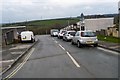
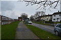
5
Inchkeith Road, Plymouth
A road on the hilltop Southway estate, seen from its junction with Skerries Road.
Image: © Derek Harper
Taken: 12 Nov 2009
0.07 miles
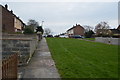
7
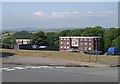
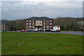
Kinnard Crescent, Southway
When the Southway Estate was built in the 1950's and 60's, so many different styles of housing were used it was almost as if the architects were trying everything out to see what they liked best. This road was lined with a number of blocks of flats of which two are pictured here.
Image: © Tony Atkin
Taken: 24 Jun 2006
0.08 miles