IMAGES TAKEN NEAR TO
Sarahs Close, PADSTOW, PL28 8BJ
Introduction
This page details the photographs taken nearby to Sarahs Close, PL28 8BJ by members of the Geograph project.
The Geograph project started in 2005 with the aim of publishing, organising and preserving representative images for every square kilometre of Great Britain, Ireland and the Isle of Man.

There are currently over 7.5m images from over14,400 individuals and you can help contribute to the project by visiting https://www.geograph.org.uk
Image Map
Images are licensed for reuse under creativecommons.org/licenses/by-sa/2.0
Notes
- Clicking on the map will re-center to the selected point.
- The higher the marker number, the further away the image location is from the centre of the postcode.
Image Listing (15 Images Found)
Images are licensed for reuse under creativecommons.org/licenses/by-sa/2.0
Image
Details
Distance
2
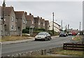
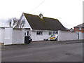
Trelawney Road, Padstow
Sometimes you can forget, amongst all the picture-postcard prettyness of the old town, that Padstow also has ordinary houses for people who are not super-rich.
Image: © Tony Atkin
Taken: 22 Jul 2006
0.11 miles
3
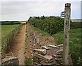
Footpath behind the Supermarket
Like finding an oasis in a desert, finding this well-used footpath means I can avoid walking along the main road for a mile.
Image: © Tony Atkin
Taken: 22 Jul 2006
0.13 miles
6
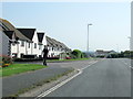
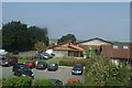
Guest house, Trelawney Road, Padstow
We stayed in this guest house, Tor View. A convenient location, we could walk down into the town centre in five minutes. An interesting arrangement of a "bungalow" with bedrooms on the ground floor and kitchen and a large lounge/dining room above.
Image: © David Hawgood
Taken: 28 Feb 2012
0.16 miles
7
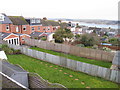
Back gardens of Glynn Road, Padstow
View from guest house in Trelawney Road with the Camel Estuary and Rock beyond the houses and gardens.
Image: © David Hawgood
Taken: 28 Feb 2012
0.18 miles
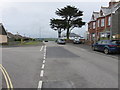
8
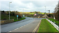
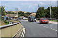
A389 in Padstow
The junction, with the B3276 New Street, is also shown in Image The A reaches its conclusion some 400 metres further on, rather ignominiously giving way to the same B road.
Image: © Derek Harper
Taken: 3 Feb 2018
0.19 miles
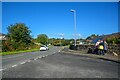
10
Sarah's Lane, Padstow
The River Camel can just be seen in the distance.
Image: © Richard Rogerson
Taken: 6 Jul 2015
0.19 miles