IMAGES TAKEN NEAR TO
Glen-Dale Crescent, ST. AUSTELL, PL25 3DD

Introduction

This page details the photographs taken nearby to Glen-Dale Crescent, PL25 3DD by members of the Geograph project.

The Geograph project started in 2005 with the aim of publishing, organising and preserving representative images for every square kilometre of Great Britain, Ireland and the Isle of Man.

There are currently over 7.5m images from over14,400 individuals and you can help contribute to the project by visiting https://www.geograph.org.uk

Image Map


Images are licensed for reuse under creativecommons.org/licenses/by-sa/2.0
Notes
  • Clicking on the map will re-center to the selected point.
  • The higher the marker number, the further away the image location is from the centre of the postcode.

Image Listing (8 Images Found)

Images are licensed for reuse under creativecommons.org/licenses/by-sa/2.0
Image
Details
Distance
1
Looking down Brockstone Road
Taken from the junction with Boscoppa Road.
Image: © Tony Atkin Taken: 12 Nov 2005
0.04 miles
2
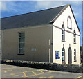
Bethel Chapel
The plaque on the front shows the year 1836 which makes it a relatively early Methodist Church. It is still in use for worship.
Image: © Tony Atkin Taken: 12 Nov 2005
0.09 miles
3
Old Direction Sign - Signpost by Bethel Road, Bethel, St Austell
Pyramid spear finial - 3 arms, 1 missing; Cornwall CC iron spear by the UC road, in parish of St Austell (Restormel District), Bethel, at crossroads with Bethel Road and Bucklers Lane, in pavement by low wall. Cornwall & Scilly HER. HER Number: MCO56826 https://www.heritagegateway.org.uk/Gateway/Results_Single.aspx?uid=MCO56826&resourceID=1020 To be surveyed Milestone Society National ID: CW_SX0352
Image: © Milestone Society Taken: Unknown
0.10 miles
4
Bible Christian chapel
Image: © Paul Barnett Taken: 1 Jan 2016
0.10 miles
5
Boscoppa
Formerly a rural area known as Boscoppa Downs, now a suburban area of St Austell.
Image: © Tony Atkin Taken: 12 Nov 2005
0.10 miles
6
Seventh Day Adventist Church
Image: © Paul Barnett Taken: Unknown
0.16 miles
7
Traffic island on Sandy Hill
Looking along Sandy Hill near Penmere Road. National Cycle Network route 3 runs along here.
Image: © DS Pugh Taken: 7 Sep 2024
0.21 miles
8
Phernyssick Road, Boscoppa
Part of the eastern side of St Austell.
Image: © Tony Atkin Taken: 12 Nov 2005
0.22 miles