IMAGES TAKEN NEAR TO
Higher Hampt, Luckett, CALLINGTON, PL17 8NP
Introduction
This page details the photographs taken nearby to PL17 8NP by members of the Geograph project.
The Geograph project started in 2005 with the aim of publishing, organising and preserving representative images for every square kilometre of Great Britain, Ireland and the Isle of Man.

There are currently over 7.5m images from over14,400 individuals and you can help contribute to the project by visiting https://www.geograph.org.uk
Image Map
Images are licensed for reuse under creativecommons.org/licenses/by-sa/2.0
Notes
- Clicking on the map will re-center to the selected point.
- The higher the marker number, the further away the image location is from the centre of the postcode.
Image Listing (3 Images Found)
Images are licensed for reuse under creativecommons.org/licenses/by-sa/2.0
Image
Details
Distance
1
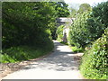
The lane leading from Luckett to Higher Hampt
Image: © Rod Allday
Taken: 22 May 2011
0.02 miles
2
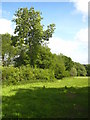
Pasture beside the stream at Higher Hampt
The stream runs along the line of the hedge.
Image: © Rod Allday
Taken: 22 May 2011
0.07 miles
3
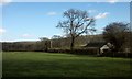
Tree and barn, Luckett
The barn is on the edge of both the village and the area of the Cornwall and West Devon Mining Landscape; the New Consols Mine mus have dominated the village in the C19 and early C20.
Image: © Derek Harper
Taken: 4 Mar 2015
0.24 miles