1
The Rectory Field, Devonport
The home ground of Devonport Services Rugby Football Club, where a match against Cleve in the Tribute South West 1 West league is about to take place. Cleve took an early lead but Devonport Services triumphed comfortably and are, at time of submission, at the top of the table. A further rugby pitch at Stonehouse Creek can be seen behind.
The houses on the right are at the ends of short terraced streets off Rectory Road. Away in the background is Millbay, with the 18-storey Chichester House.
Image: © Derek Harper
Taken: 19 Oct 2019
0.03 miles
2
City College, Plymouth
Buildings facing the southeast side of the campus. On the immediate left is
Image], followed by the Construction Centre.
Image: © Derek Harper
Taken: 19 Oct 2019
0.04 miles
3
Bridge, Corea Terrace, Plymouth
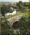
The old railway bridge is shown from above in
Image http://www.chrisrobinson.co.uk/places/coreaterrace.shtml suggests that Corea Terrace is named after Korea at the time that C J Corfe, formerly a Royal Naval chaplain, became the country's first Anglican bishop.
Image: © Derek Harper
Taken: 26 Mar 2011
0.04 miles
4
Former railway bridge, Devonport
Another view of
Image from City College's car park. The bridge is now used as a path to Stonehouse Creek. In the background is Stonehouse.
Image: © Derek Harper
Taken: 19 Oct 2019
0.04 miles
5
Old railway bridge crossing Corea Terrace
The bridge formerly carried a single track freight railway to the oil terminal at Devonport New Quays. It is now used for an urban path
Image See
Image for an explanation of the road name.
Image: © Stephen Craven
Taken: 28 Jun 2023
0.04 miles
6
Wall postbox on Rectory Road
The bridge in the background formerly carried a single track freight railway to the oil terminal at Devonport New Quays. It is now used for an urban path
Image See
Image for an explanation of the road name.
Image: © Stephen Craven
Taken: 28 Jun 2023
0.04 miles
7
Construction Centre, City College, Plymouth
Image: © Derek Harper
Taken: 19 Oct 2019
0.04 miles
8
City College, Plymouth
The Hospitality building on the south corner of the campus.
Image: © Derek Harper
Taken: 19 Oct 2019
0.05 miles
9
Former railway bridge and trackbed, Stonehouse
View south along the trackbed of this former LSWR branchline. Photographed from the site of the former LSWR station that was demolished to make way for Plymouth College of Further Education. The grassed area south of the terraced houses was formerly a tidal creek. It was infilled, I believe, in the 1960's. This view is 1979.
Image: © Crispin Purdye
Taken: Unknown
0.05 miles
10
STEM Centre, City College, Plymouth
The £13m Regional Centre of Excellence for STEM (science, technology, engineering and maths) was opened in 2017. It may havs been built on the site of several car parks, but I'm sure it was worth it.
Image: © Derek Harper
Taken: 19 Oct 2019
0.06 miles


