IMAGES TAKEN NEAR TO
Hockings Green, LISKEARD, PL14 3FX
Introduction
This page details the photographs taken nearby to Hockings Green, PL14 3FX by members of the Geograph project.
The Geograph project started in 2005 with the aim of publishing, organising and preserving representative images for every square kilometre of Great Britain, Ireland and the Isle of Man.

There are currently over 7.5m images from over14,400 individuals and you can help contribute to the project by visiting https://www.geograph.org.uk
Image Map
Images are licensed for reuse under creativecommons.org/licenses/by-sa/2.0
Notes
- Clicking on the map will re-center to the selected point.
- The higher the marker number, the further away the image location is from the centre of the postcode.
Image Listing (16 Images Found)
Images are licensed for reuse under creativecommons.org/licenses/by-sa/2.0
Image
Details
Distance
1
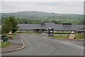
Carlton Way, Liskeard
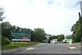
Access road from the bypass to a growing (in 2021) housing estate
Image: © David Smith
Taken: 6 Jul 2021
0.09 miles
2
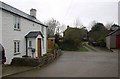
Trembraze
The junction in the centre of a small hamlet northeast of Liskeard, at the eastern edge of the square.
Image: © Derek Harper
Taken: 22 Jan 2009
0.09 miles
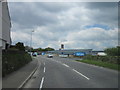
3
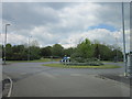
The A390, Charter Way at Callington Road, Liskeard
Image: © Ian S
Taken: 25 May 2013
0.14 miles
5
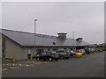
The New Liskeard Hospital
Constructed recently to replace the old Passmore Edwards hospital in Liskeard Town Centre, the new Liskeard Hospital is a welcome addition to local health services, as well as looking ultra modern with a pleasing design.
Image: © Eric Foster
Taken: 17 Aug 2011
0.19 miles
6
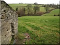
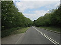
Lane to Welltown
Trees along the tiny dead-end lane to the hamlet shown in Image crosses a small valley. Seen looking along the very western edge of the square from beside an outbuilding at Trembraze, on the lane to Hendra Bridge.
Image: © Derek Harper
Taken: 22 Jan 2009
0.21 miles
7
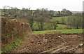
Towards Welltown
Looking across a side valley of the River Seaton, from the lane east of Trembraze. Welltown is a tiny hamlet of about four houses.
Image: © Derek Harper
Taken: 22 Jan 2009
0.22 miles
8
Liskeard Community Hospital
This new community hospital offers a far more limited range of treatments than a large general hospital, but at least it is close to the people who need to use it.
Image: © Tony Atkin
Taken: 13 May 2006
0.22 miles
10
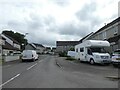
Stephens Road, Liskeard
Part of a housing estate on the north-east side of Liskeard
Image: © David Smith
Taken: 6 Jul 2021
0.23 miles