IMAGES TAKEN NEAR TO
Landrake, SALTASH, PL12 5AG
Introduction
This page details the photographs taken nearby to PL12 5AG by members of the Geograph project.
The Geograph project started in 2005 with the aim of publishing, organising and preserving representative images for every square kilometre of Great Britain, Ireland and the Isle of Man.

There are currently over 7.5m images from over14,400 individuals and you can help contribute to the project by visiting https://www.geograph.org.uk
Image Map
Images are licensed for reuse under creativecommons.org/licenses/by-sa/2.0
Notes
- Clicking on the map will re-center to the selected point.
- The higher the marker number, the further away the image location is from the centre of the postcode.
Image Listing (7 Images Found)
Images are licensed for reuse under creativecommons.org/licenses/by-sa/2.0
Image
Details
Distance
1
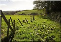
Field at Trevashmond
From the lane shown in Image], looking to the left.
Image: © Derek Harper
Taken: 10 Oct 2013
0.02 miles
2
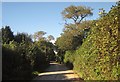
Lane at Trevashmond
The lane to Blunts passes the entrance to the farm, on the left by the trees.
Image: © Derek Harper
Taken: 10 Oct 2013
0.03 miles
3
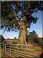
Oak at Trevashmond
A fine oak tree in a bank opposite the entrance to the farm.
Image: © Derek Harper
Taken: 10 Oct 2013
0.03 miles
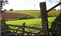
4
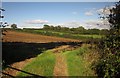
Farmland near Trevashmond
Looking past the left-hand of the two gates shown in Image] across the head of the valley of a small tributary of the Lynher.
Image: © Derek Harper
Taken: 10 Oct 2013
0.08 miles
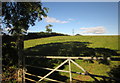
5
Farmland near Trevashmond
From the same spot as Image], over two gates, a glimpse of the valley below Trevashmond.
Image: © Derek Harper
Taken: 10 Oct 2013
0.10 miles
6
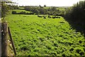
Cattle near Trevashmond
Lush grass by the lane from Fair View, with the valley at Trewandra in the background.
Image: © Derek Harper
Taken: 10 Oct 2013
0.16 miles
7
Field east of Trevashmond
Image: © Derek Harper
Taken: 10 Oct 2013
0.23 miles