IMAGES TAKEN NEAR TO
Ballinluig, PITLOCHRY, PH9 0NN

Introduction

This page details the photographs taken nearby to PH9 0NN by members of the Geograph project.

The Geograph project started in 2005 with the aim of publishing, organising and preserving representative images for every square kilometre of Great Britain, Ireland and the Isle of Man.

There are currently over 7.5m images from over14,400 individuals and you can help contribute to the project by visiting https://www.geograph.org.uk

Image Map


Images are licensed for reuse under creativecommons.org/licenses/by-sa/2.0
Notes
  • Clicking on the map will re-center to the selected point.
  • The higher the marker number, the further away the image location is from the centre of the postcode.

Image Listing (21 Images Found)

Images are licensed for reuse under creativecommons.org/licenses/by-sa/2.0
  • ...
Image
Details
Distance
1
Woods below Cuil an Duin
Close to the A9.
Image: © Russel Wills Taken: 3 Feb 2012
0.09 miles
2
A frozen burn
In trees beside the A9.
Image: © Russel Wills Taken: 3 Feb 2012
0.12 miles
3
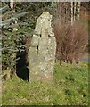
Cross slab near Westhaugh of Tulliemet
Just beside the busy A9 beside Haugh Cottages. A plain cross-slab (with the cross repeated on both sides of the stone) is to be seen "at the side of the Dunkeld road on the farm of West Haugh of Tulliemet, 10 or 12 yards from the high road and on the S side of it." It is said to have been connected with a chapel of St Maroc on the terrace above. The stone is 6' in height above ground and 8" - 10" thick. J H Dixon 1925
Image: © Russel Wills Taken: 3 Feb 2012
0.12 miles
4
Cross slab near Westhaugh of Tulliemet
The side in shadow. For the sunny side see: http://www.geograph.org.uk/photo/2789481
Image: © Russel Wills Taken: 3 Feb 2012
0.13 miles
5
Burn and fence near Cuil an Duin
Crossing the boggy field to the left, to access this square, was only possible because it was frozen solid!
Image: © Russel Wills Taken: 3 Feb 2012
0.14 miles
6
Almost frozen burn
With birch wood beyond.
Image: © Russel Wills Taken: 3 Feb 2012
0.14 miles
7
Frozen burn in the woods
The A9 is just beyond the trees.
Image: © Russel Wills Taken: 3 Feb 2012
0.14 miles
8
Haugh Cottages Cross Slab
This is a Pictish Cross Slab rather than a standing stone but that seems to be nearest category.
Image: © Ewen Rennie Taken: Unknown
0.14 miles
9
Layby number 31, Northbound A9
As you travel along the A9 between Perth and Cromarty Bridge, there is a series of laybys at fairly regular intervals on both sides of the road. These laybys are numbered consecutively from south to north. The layby furthest north is number 200. Layby 31 is on the northbound carriageway near Haugh of Kilmorich.
Image: © David Dixon Taken: 3 Apr 2017
0.15 miles
10
West Haugh of Tullimet
Viewed from the A9 Perth to Inverness trunk road.
Image: © Dave Fergusson Taken: 12 Mar 2010
0.16 miles
  • ...