
IMAGES TAKEN NEAR TO
Willowgate Drive, PERTH, PH2 7FA
Introduction
This page details the photographs taken nearby to Willowgate Drive, PH2 7FA by members of the Geograph project.
The Geograph project started in 2005 with the aim of publishing, organising and preserving representative images for every square kilometre of Great Britain, Ireland and the Isle of Man.

There are currently over 7.5m images from over14,400 individuals and you can help contribute to the project by visiting https://www.geograph.org.uk
Image Map
Images are licensed for reuse under creativecommons.org/licenses/by-sa/2.0
Notes
- Clicking on the map will re-center to the selected point.
- The higher the marker number, the further away the image location is from the centre of the postcode.
Image Listing (22 Images Found)
Images are licensed for reuse under creativecommons.org/licenses/by-sa/2.0
Image
Details
Distance
1
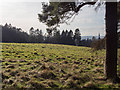
Field above St Mary's Monastery
This field belongs to the monastery, which can be seen on the right. Although this is in the designated green belt and an area of great landscape value (AGLV), nevertheless it has been granted planning permission for housing. This is as an "enabling development" allowed to protect a heritage asset.
Image: © Rob Burke
Taken: 17 Feb 2013
0.02 miles
2
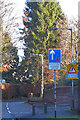
Priority Sign
There are two narrow points on Hatton Road, at both of which (quite properly) uphill traffic has priority over downhill traffic.
Image: © Anne Burgess
Taken: 26 Nov 2017
0.07 miles
3
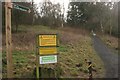
Path to Kinnoull Hill summit
Direction and warning signs at start of the path to the top of Kinnoull Hill. The top sign warns of the dangers of the unprotected cliff at the top. Unfortunately several people have committed suicide by jumping from the top - hence the Samaritans sign at the bottom.
Image: © Richard Sutcliffe
Taken: 8 Feb 2016
0.08 miles
4
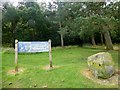
Kinnoull Hill Woodland Park
There are paths everywhere through the trees in Kinnoull Hill Woodland Park. So which route will you pick?
Image: © Rude Health
Taken: 8 Aug 2014
0.09 miles
5
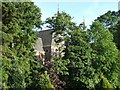
St. Mary's Monastery, Kinnoull
The monastery is on the hillside overlooking Perth. A spring in the grounds feeds a burn which runs down through trees and gardens into the Tay.
Image: © Lis Burke
Taken: 19 Jun 2005
0.09 miles
6
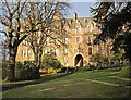
St Mary's monastery
A view of the monastery's residential wing viewed from across the garden.
Image: © Lis Burke
Taken: 28 Jan 2012
0.09 miles
7
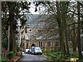
Visiting vehicles
At St Mary's Monastery.
Image: © James Allan
Taken: 4 Mar 2013
0.10 miles
8
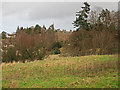
St Mary's Monastery
A view from the lower slopes of Kinnoull Hill, just below the woodland.
Image: © Lis Burke
Taken: 3 Jan 2012
0.10 miles
9
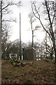
Radio mast, Kinnoull Hill
Small building and radio mast amongst the trees on Kinnoull Hill.
Image: © Richard Sutcliffe
Taken: 8 Feb 2016
0.15 miles
10
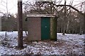
Abandoned radio equipment hut on Kinnoull Hill
This hut looks as if it once housed radio equipment connected to the wooden mast beside it. The building is starting to decay.
Image: © Rob Burke
Taken: 18 Dec 2010
0.16 miles